Connecticut/MetroCOG
Jump to navigation
Jump to search
The Connecticut Metropolitan Council of Governments (MetroCOG) is a multi-discipline regional planning organization that is guided by a cooperative partnership between the Region’s six member municipalities:
- City of Bridgeport
- Town of Easton
- Town of Fairfield
- Town of Monroe
- Town of Stratford
- Town of Trumbull
MetroCOG serves as a regional clearinghouse for spatial data, they can be found at https://gis-ctmetro.opendata.arcgis.com/.
Imagery
MetroCOG provides aerial imagery for all members, it can be found at https://ctmetro.org/gis-shared-services/.
License
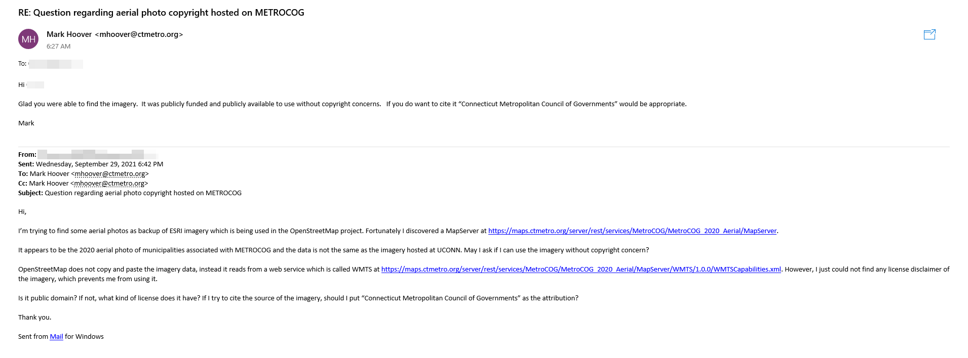
MetroCOG GIS Director Mark Hoover has approved the imagery usage in OpenStreetMap as free data. A proof has been obtained and uploaded to the OpenStreetMap Wiki. 
Usage
If you wish to use this imagery out of iD, please follow the instruction at https://github.com/osmlab/editor-layer-index.