Creating a panorama with OS OpenData
OS OpenData Land-Form PANORAMA data is now available as a series of binary heightfiles from here.
I have created some basic code in C to allow users to transform these height files into full 360º generated panoramas from anywhere in Great Britain. It could probably do with a bit of refining and efficiency improvements, but it does work on my machine, and seems to give acceptable results.
As a default, the panorama generator creates a file detailing the apparent altitude of concentric circles at 200m intervals, plotting points at 0.1 degree intervals on each circle. Then file can then be transformed into a bitmap file - rendering the full 360 panorama.
The panorama & bitmap files can be quite large.
The full source code will be provided shortly.
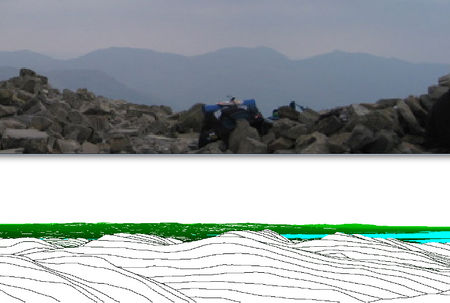
Example - from summit of Scafell Pike

The comparisons above show a photo taken on a reasonably hazy day from the summit of Scafell Pike (full panorama on OpenTrailView), vs the computer generated panorama.
Due to the haze - hills & mountains further than about 15 miles away were not visible on the photos.
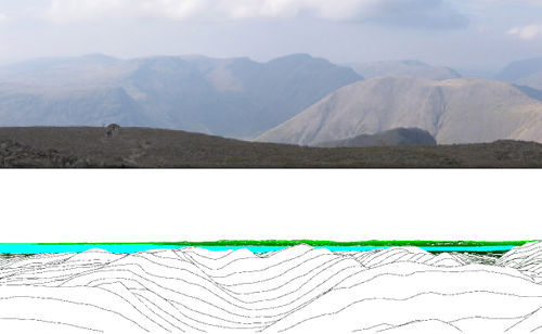
Example2 - from summit of Winter Hill near Bolton
A longer distance comparison. In this example, nice lighting conditions in the late afternoon and clearing skies to the west allowed this great view of the mountains of Snowdonia and the Great Orme near Llandudno from the summit of Winter Hill near Bolton - a distance of ~75 miles. The panorama is from Moel Siabod on the far left, via Snowdon & the Glyderau to the massive Carneddau range which makes up most of the central part, and finally the Great Orme near Llandudno on the far right.
Potential OSM applications
This could be used to provide "footpath-eye-views", e.g. similar to OS's Memory map perhaps.


