Dumfries/Mapping Party 2009-10
Summary
There will be a mapping party in Dumfries on the weekend of 10/11 October 2009. A mapping party is an informal, community event where everyone from beginners to experience mappers can gather together to help map a town or area (see here for more about mapping parties)
There is no Yahoo or Satellite imagery that OSMers can use, so all data needs to be collected using GPS, or Walking Papers. All main roads and some residential areas are already complete. National Cycle Network Route 7 passes through the town.
- Sally Hinchcliffe ('disgruntled' on OSM)
- Email: sallyhinchcliffe@googlemail.com
- Phone: 07952 645870
Or
- Shaun McDonald Smsm1
- Email: shaun@shaunmcdonald.me.uk
- Phone: 0787 9610632
For an example of the Press Release issued see Dumfries/MappingParty2009-10/Press_Release
Accommodation
There are a number of B&Bs in the town, prices are from about £30 per person per night. There is also a lot of self-catering accommodation in the surrounding area which may work out cheaper if you're staying for a few nights. Be aware that the rural bus service is fairly patchy (and often doesn't run after 5 pm or on Sundays) so this may be a problem if you don't have your own transport.
Visit Scotland lists B&Bs and Self Catering establishments. You can book through them (for a small fee) or get details of accommodation and then book direct.
How to get there
Train
Trains run to Dumfries from Glasgow Central and Carlisle, every 2-3 hours. Coming from Edinburgh, it's faster (and cheaper) to take the train to Lockerbie and then the bus to Dumfries, which stops near the train station. Most of the trains have dedicated space for bikes but the Lockerbie bus will not accommodate bikes. (More detail on bringing your bike on the train here)
Bus and Coach
Buses and coaches run from Edinburgh, Glasgow and Carlisle. Traveline Scotland is the best resource for planning journeys to and from Dumfries
Bicycle
Dumfries is on National Cycle Route 7, and the National Cycle Byway. It's reasonably hilly (and can be very wet) so come prepared - but the cycling on the rural roads around Dumfries is some of the best in the country.
What to bring
- Appropriate Clothing
- If you have one:
- GPS
- Camera
- Pen and/or clipboard
- Laptop for entering the data
Before and After
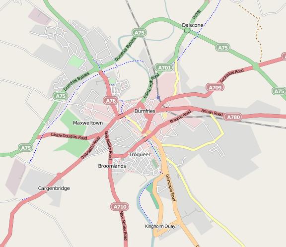
Here's how the map looked before the mapping weekend:
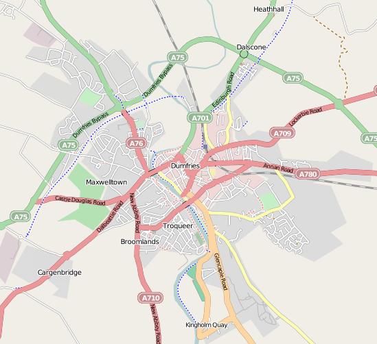
And here it is after all the edits had been completed:

