File:012 Made a copy of the other stop area relation and add everything for the northern side of the street.png
Original file (1,291 × 517 pixels, file size: 626 KB, MIME type: image/png)
Summary
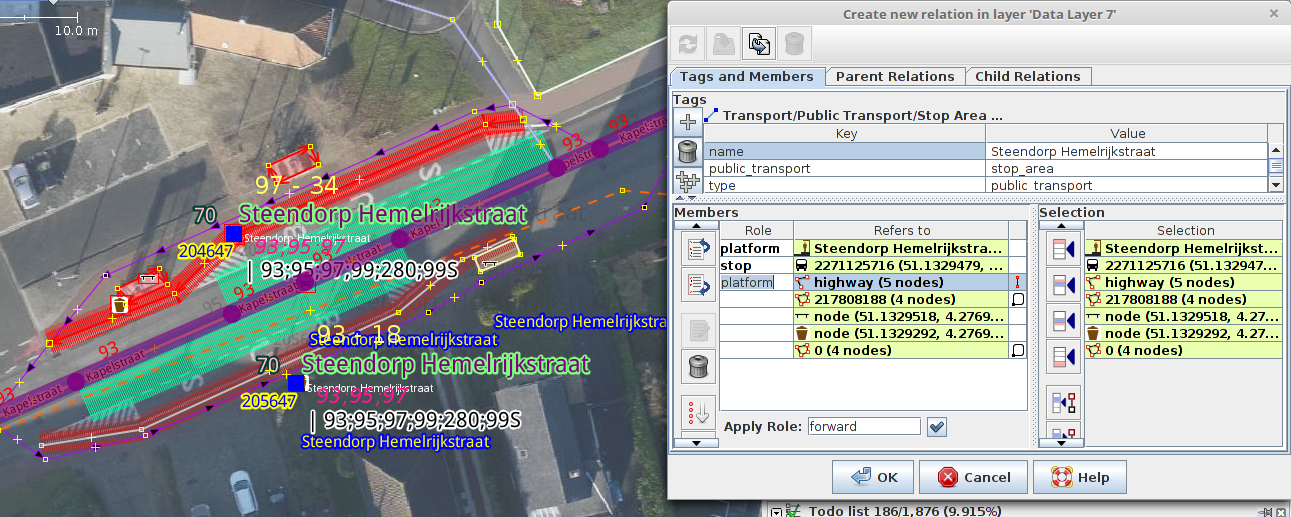
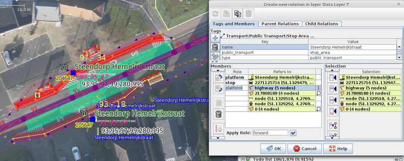
To create the stop_area relation for the other side of the road, it's possible to use copy relation from the relation editor.
Licensing
![]()
![]()
Imagery in background: Orthophoto Flanders by Agentschap voor Geografische Informatie Vlaanderen (AGIV), Digitaal Vlaanderen, published under Gratis open data licentie Vlaanderen https://data.vlaanderen.be/doc/licentie/modellicentie-gratis-hergebruik/v1.0, https://www.vlaanderen.be/digitaal-vlaanderen/onze-oplossingen/open-data/voorwaarden-voor-het-hergebruik-van-overheidsinformatie/modellicentie-gratis-hergebruik, see Wiki page AGIV CRAB Import/Free open data licence Flanders
Data displayed: minimalFile history
Click on a date/time to view the file as it appeared at that time.
| Date/Time | Thumbnail | Dimensions | User | Comment | |
|---|---|---|---|---|---|
| current | 19:25, 31 August 2017 | 1,291 × 517 (626 KB) | Polyglot (talk | contribs) | To create the stop_area relation for the other side of the road, it's possible to use copy relation from the relation editor. |
You cannot overwrite this file.
File usage
The following 4 pages use this file: