File:AF 5 C - Camels Hump 2a.jpg
Jump to navigation
Jump to search

Size of this preview: 800 × 600 pixels. Other resolutions: 320 × 240 pixels | 640 × 480 pixels | 1,024 × 768 pixels | 1,280 × 960 pixels | 2,560 × 1,920 pixels | 4,032 × 3,024 pixels.
Original file (4,032 × 3,024 pixels, file size: 2.86 MB, MIME type: image/jpeg)
Summary
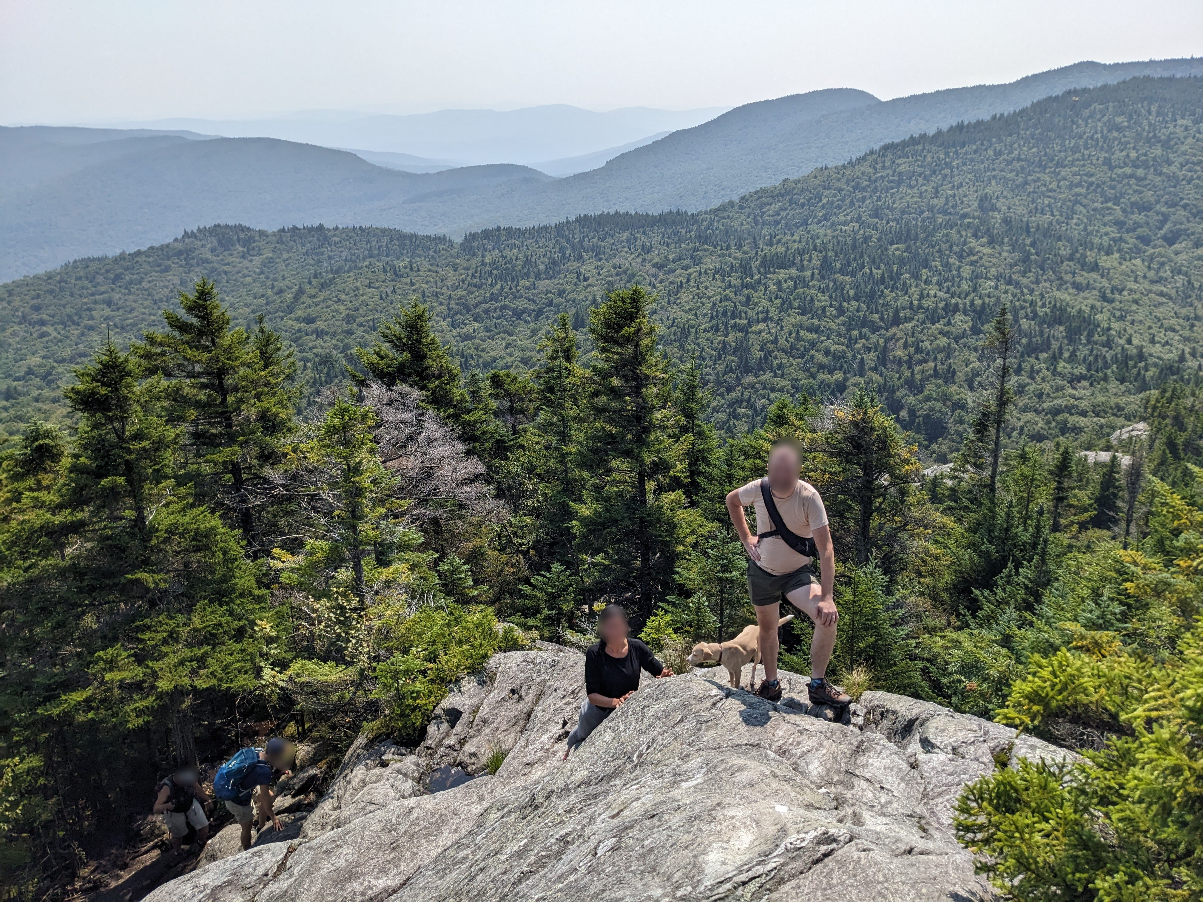
| Description | A steep, scramble section of the Long Trail on the ridge south of Camel's Hump. |
|---|---|
| Author | Adam Franco |
| Source | |
| Date | Aug 20, 2023 at 11:48:48 AM |
Licensing
- This media file was uploaded by author of the work and its copyright holder.
![]()
![]()
This work is licensed under the Creative Commons Attribution 4.0 License.
Attribution: Adam Franco
Attribution: Adam Franco
File history
Click on a date/time to view the file as it appeared at that time.
| Date/Time | Thumbnail | Dimensions | User | Comment | |
|---|---|---|---|---|---|
| current | 16:03, 19 December 2023 | | 4,032 × 3,024 (2.86 MB) | Adamfranco (talk | contribs) | {{Information | description=A steep, scramble section of the Long Trail on the ridge south of Camel's Hump. | source= | date=Aug 20, 2023 at 11:48:48 AM | author=Adam Franco | other_versions= }} |
You cannot overwrite this file.
File usage
The following 2 pages use this file: