File:Age of building Leiden.png
Jump to navigation
Jump to search


Size of this preview: 800 × 475 pixels. Other resolutions: 320 × 190 pixels | 640 × 380 pixels | 1,177 × 699 pixels.
Original file (1,177 × 699 pixels, file size: 1.22 MB, MIME type: image/png)
Summary
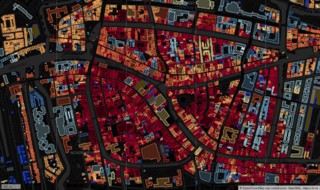
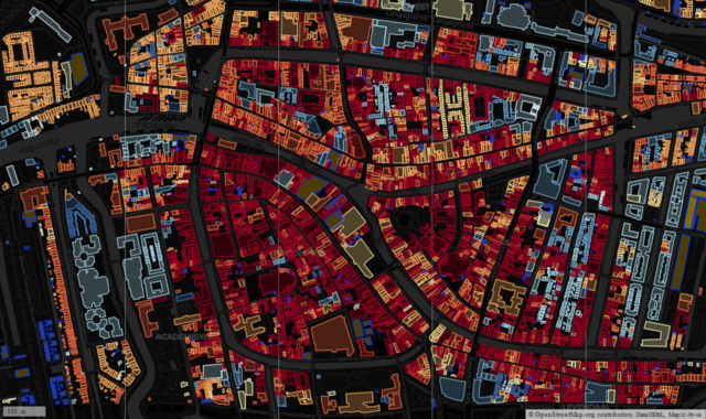
| Description | A map of building age in Leiden, The Netherlands. Colour coding is based on that at http://code.waag.org/buildings/ |
|---|---|
| Author | SK53 |
| Source | OpenStreetMap, start_date from BAG import |
| Date | 2022-11-28 |
| Permission | CC-BY-SA |
Licensing
| Contains map data © OpenStreetMap contributors, made available under the terms of the Open Database License (ODbL).
The ODbL does not require any particular license for maps produced from ODbL data, produced maps may be subject also to other licences. |
File history
Click on a date/time to view the file as it appeared at that time.
| Date/Time | Thumbnail | Dimensions | User | Comment | |
|---|---|---|---|---|---|
| current | 10:39, 30 November 2022 | | 1,177 × 699 (1.22 MB) | SK53 (talk | contribs) | {{Information | description=A map of building age in Leiden, The Netherlands. Colour coding is based on that at http://code.waag.org/buildings/ | source=OpenStreetMap, start_date from BAG import | date=2022-11-28 | author=SK53 | permission=CC-BY-SA | other_versions= }} |
You cannot overwrite this file.
File usage
There are no pages that use this file.