File:Antarctica coast profile.png
Jump to navigation
Jump to search

Size of this preview: 800 × 343 pixels. Other resolutions: 320 × 137 pixels | 1,055 × 452 pixels.
Original file (1,055 × 452 pixels, file size: 40 KB, MIME type: image/png)
Summary
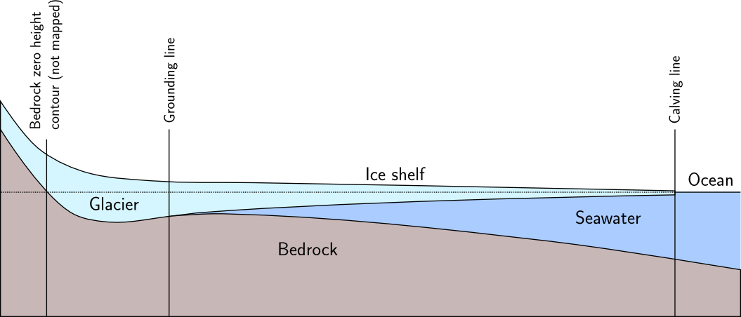
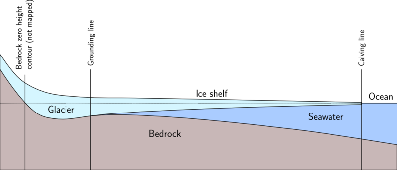
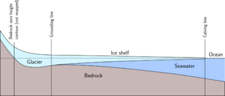
Profile of the antarctic coast with ice shelf, approximately to scale except for vertical exaggeration
Licensing
![]()
![]()
![]()
This work is licensed under the Creative Commons Attribution-ShareAlike 2.0 License.
Attribution not specified as a parameter! THIS LICENSE ALWAYS REQUIRES ATTRIBUTION! Use {{CC-BY-SA-2.0|Attribution, typically name of author}} See Template:CC-BY-SA-2.0 for full description how this template should be used.
Note, there is
There is also
Attribution not specified as a parameter! THIS LICENSE ALWAYS REQUIRES ATTRIBUTION! Use {{CC-BY-SA-2.0|Attribution, typically name of author}} See Template:CC-BY-SA-2.0 for full description how this template should be used.
Note, there is
{{CC-BY-SA-2.0 OpenStreetMap}} for files based on old OSM map data, before the license change made on 2012-09-12.There is also
{{OSM Carto screenshot||old_license}} for files based on old OSM map data, before the license change made on 2012-09-12, created using OSM Carto map style.
File history
Click on a date/time to view the file as it appeared at that time.
| Date/Time | Thumbnail | Dimensions | User | Comment | |
|---|---|---|---|---|---|
| current | 09:48, 11 March 2013 | | 1,055 × 452 (40 KB) | Imagico (talk | contribs) | Profile of the antarctic coast with ice shelf, approximately to scale except for vertical exaggeration |
You cannot overwrite this file.
File usage
The following page uses this file: