Summary
| Description
|
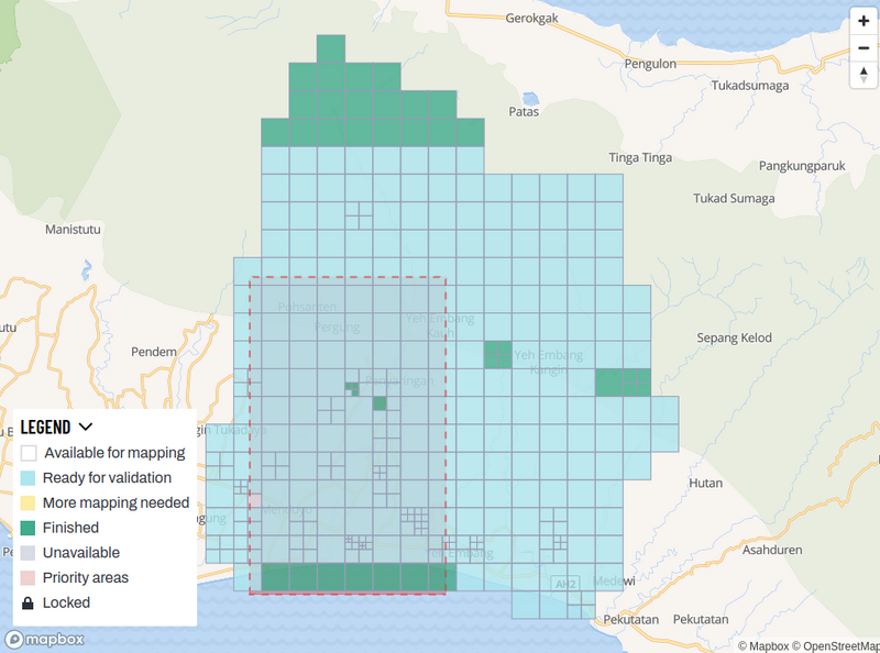
Snapshot from the project in Tasking Manager for the Bali flooding activation in 2022
|
| Author
|
na
|
| Source
|
HOT Tasking Manager
|
| Date
|
02 November 2022
|
Licensing

|
|
Contains map data © OpenStreetMap contributors, made available under the terms of the Open Database License (ODbL).
The ODbL does not require any particular license for maps produced from ODbL data, produced maps may be subject also to other licences.
|

|
|
Contains map tiles in Humanitarian map style, a stylesheet designed by Yohan Boniface and others in the Humanitarian OSM Team, published on github with a CC0 license.
|
File history
Click on a date/time to view the file as it appeared at that time.
| Date/Time | Thumbnail | Dimensions | User | Comment |
|---|
| current | 09:22, 2 November 2022 |  | 951 × 706 (182 KB) | Pedrito1414 (talk | contribs) | {{Information | description=Snapshot from the project in Tasking Manager for the Bali flooding activation in 2022 | source=HOT Tasking Manager | date=02 November 2022 | author=na | permission= | other_versions= }} |
You cannot overwrite this file.
File usage
The following page uses this file:
This file contains additional information, probably added from the digital camera or scanner used to create or digitize it.
If the file has been modified from its original state, some details may not fully reflect the modified file.
