File:BikeLaneCrossingDriveLane.png
Jump to navigation
Jump to search

Size of this preview: 591 × 599 pixels. Other resolutions: 237 × 240 pixels | 473 × 480 pixels | 655 × 664 pixels.
Original file (655 × 664 pixels, file size: 219 KB, MIME type: image/png)
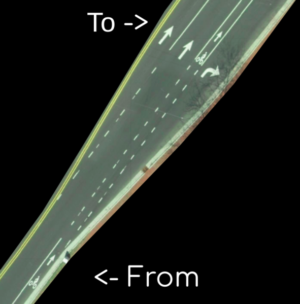
An image of downtown Chapel Hill North Carolina USA roads showing a place where a driving lane crosses a cycle lane. This could be tagged with the new connectivity relation. Image of https://www.osm.org/#map=19/35.90407/-79.05505
File history
Click on a date/time to view the file as it appeared at that time.
| Date/Time | Thumbnail | Dimensions | User | Comment | |
|---|---|---|---|---|---|
| current | 02:35, 19 April 2019 | | 655 × 664 (219 KB) | LeifRasmussen (talk | contribs) |
You cannot overwrite this file.
File usage
There are no pages that use this file.