File:Br-classificacao-pindamonhangaba-sp-plano-diretor.jpg
Jump to navigation
Jump to search


Size of this preview: 452 × 600 pixels. Other resolutions: 181 × 240 pixels | 362 × 480 pixels | 579 × 768 pixels | 1,024 × 1,359 pixels.
Original file (1,024 × 1,359 pixels, file size: 432 KB, MIME type: image/jpeg)
Summary
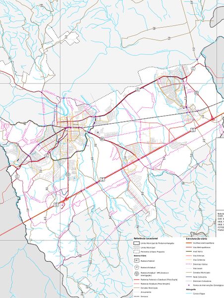
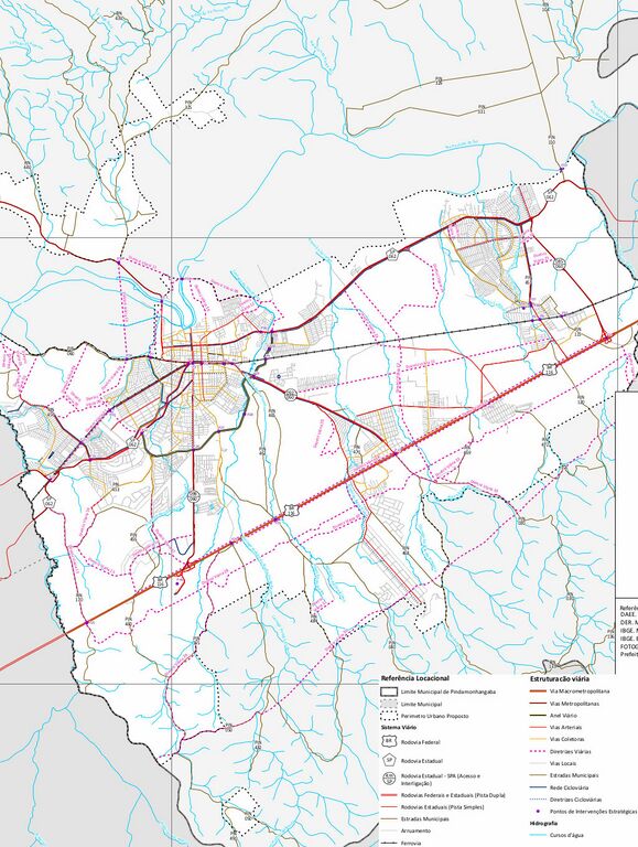
Classificação oficial segundo o plano diretor, publicada em 15 de janeiro de 2020.
Disponível oficialmente no site da Prefeitura em Portais > Plano diretor > Revisão plano diretor Pindamonhangaba, em:
- Mapa 2 - Estruturação viária
- Relatório > Mapa - Estruturação viária do município de Pindamonhangaba, pág. 68
Licensing
![]()
This file has been released into the public domain by the copyright holder, its copyright has expired, or it is ineligible for copyright. This applies worldwide.
Please, please use more specific template such as {{PD-self}} / {{PD-creator}} / {{PD-shape}} / {{PD-USGov}} / {{PD-old}} / {{PD-RU-exempt}} ... This template is not making clear why this work is in the public domain.
Please, please use more specific template such as {{PD-self}} / {{PD-creator}} / {{PD-shape}} / {{PD-USGov}} / {{PD-old}} / {{PD-RU-exempt}} ... This template is not making clear why this work is in the public domain.
File history
Click on a date/time to view the file as it appeared at that time.
| Date/Time | Thumbnail | Dimensions | User | Comment | |
|---|---|---|---|---|---|
| current | 13:09, 2 December 2020 | | 1,024 × 1,359 (432 KB) | Ftrebien (talk | contribs) | Atualizado a partir do projeto de lei de revisão do plano diretor. |
| 12:40, 2 December 2020 | 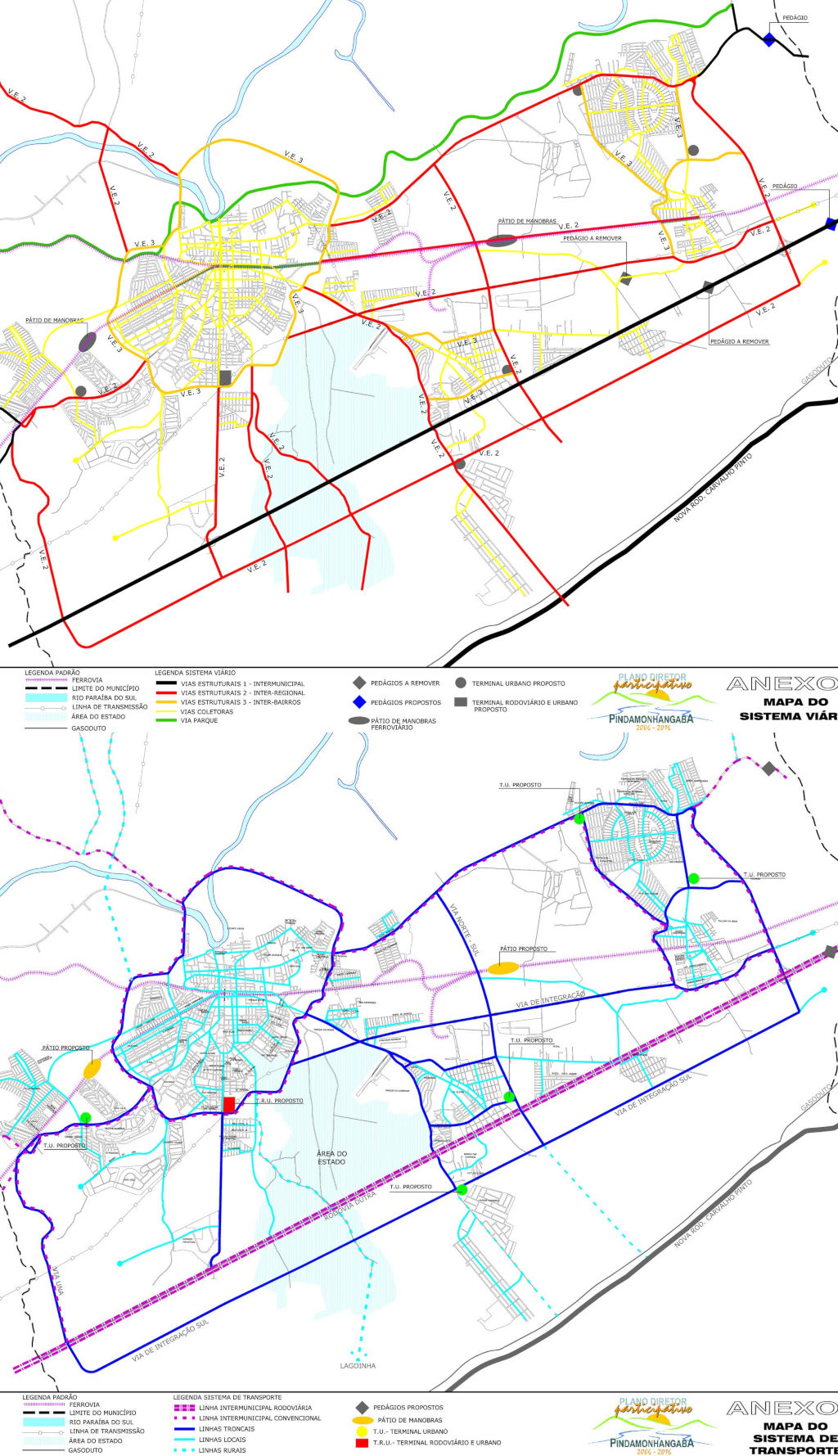 | 1,024 × 1,779 (380 KB) | Ftrebien (talk | contribs) | Classificação oficial segundo o plano diretor, publicada em 10 de outubro de 2006. Disponível oficialmente no site da [https://www.pindamonhangaba.sp.gov.br/ Prefeitura] em Portais > [https://www.pindamonhangaba.sp.gov.br/portais/plano-diretor Plano diretor] > [https://www.pindamonhangaba.sp.gov.br/portais/plano-diretor/mapas-plano-diretor Mapas plano diretor], em: * [https://www.pindamonhangaba.sp.gov.br/site/wp-content/uploads/2019/01/Mapa-do-Sistema-Vi%C3%A1rio.jpg Mapa do sistema viário]... |
You cannot overwrite this file.
File usage
The following page uses this file: