File:Br-classificacao-vila-velha-es-plano-diretor.jpg
Jump to navigation
Jump to search

Size of this preview: 350 × 599 pixels. Other resolutions: 140 × 240 pixels | 280 × 480 pixels | 448 × 768 pixels | 1,024 × 1,753 pixels.
Original file (1,024 × 1,753 pixels, file size: 397 KB, MIME type: image/jpeg)
Summary
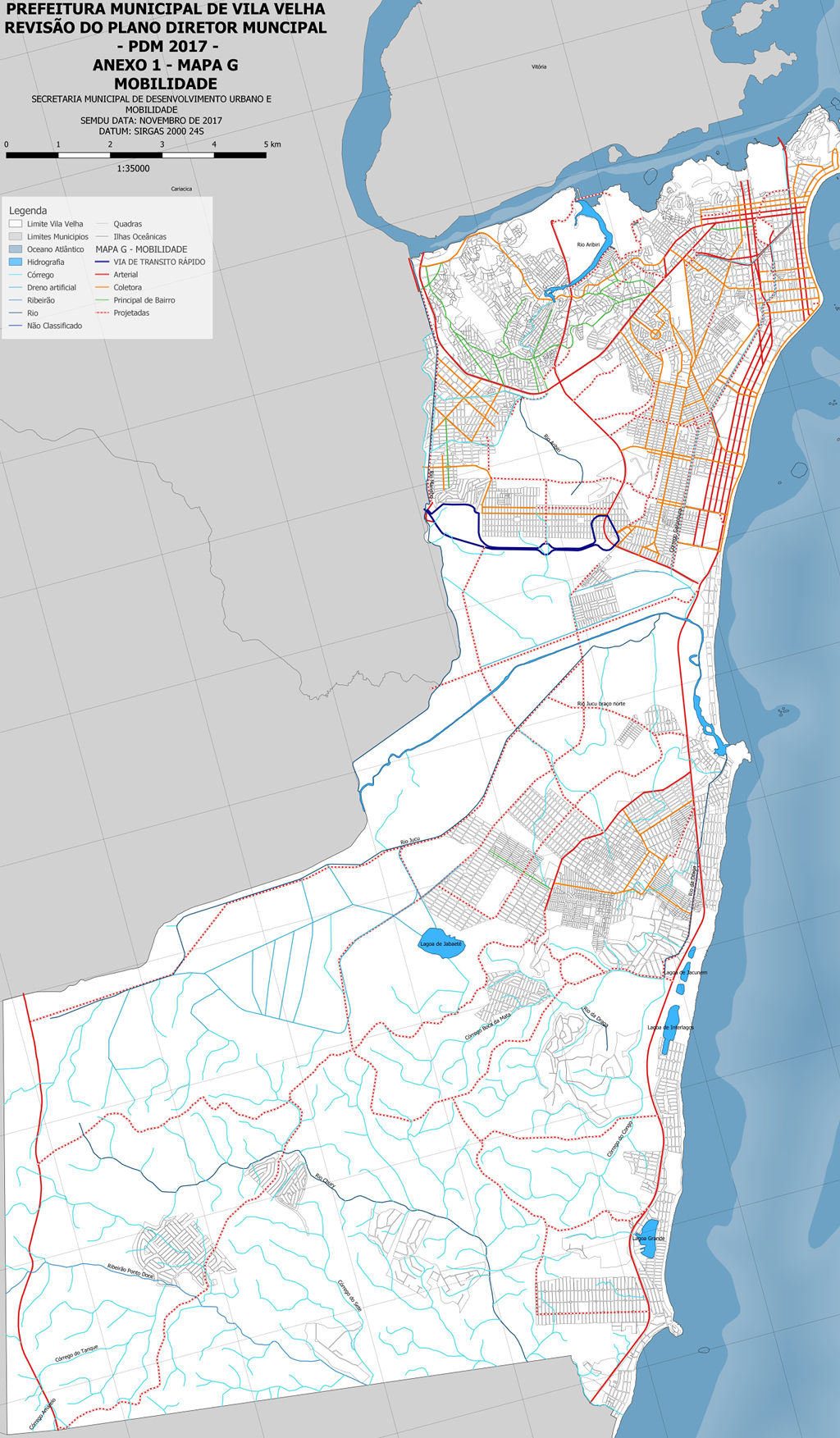
Classificação oficial segundo o plano diretor, publicada em 9 de novembro de 2018.
Disponível oficialmente no site da Prefeitura em Cidadão > Legislação online > Consulta geral > Lei complementar 65 - 2018 > Anexo 1 - Mapa G - Mobilidade.
Licensing
![]()
This file has been released into the public domain by the copyright holder, its copyright has expired, or it is ineligible for copyright. This applies worldwide.
Please, please use more specific template such as {{PD-self}} / {{PD-creator}} / {{PD-shape}} / {{PD-USGov}} / {{PD-old}} / {{PD-RU-exempt}} ... This template is not making clear why this work is in the public domain.
Please, please use more specific template such as {{PD-self}} / {{PD-creator}} / {{PD-shape}} / {{PD-USGov}} / {{PD-old}} / {{PD-RU-exempt}} ... This template is not making clear why this work is in the public domain.
File history
Click on a date/time to view the file as it appeared at that time.
| Date/Time | Thumbnail | Dimensions | User | Comment | |
|---|---|---|---|---|---|
| current | 04:30, 17 July 2020 | | 1,024 × 1,753 (397 KB) | Ftrebien (talk | contribs) | Atualizado pelo PDM 2018. |
| 00:02, 26 September 2017 | 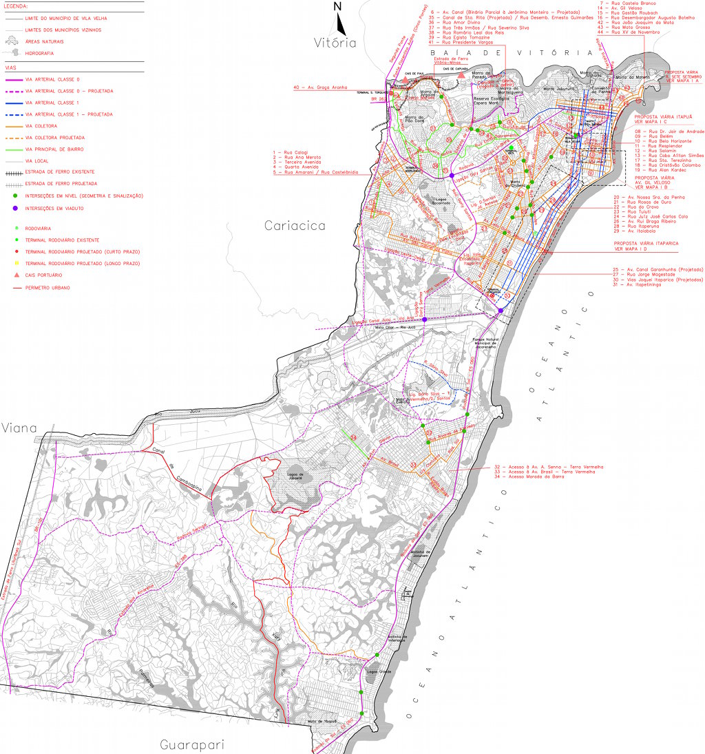 | 1,024 × 1,095 (287 KB) | Ftrebien (talk | contribs) | Recuperado o texto original e melhorado o esquema de compressão da imagem para preservar mais detalhes e reduzir o tamanho final do arquivo. | |
| 20:06, 3 January 2016 | 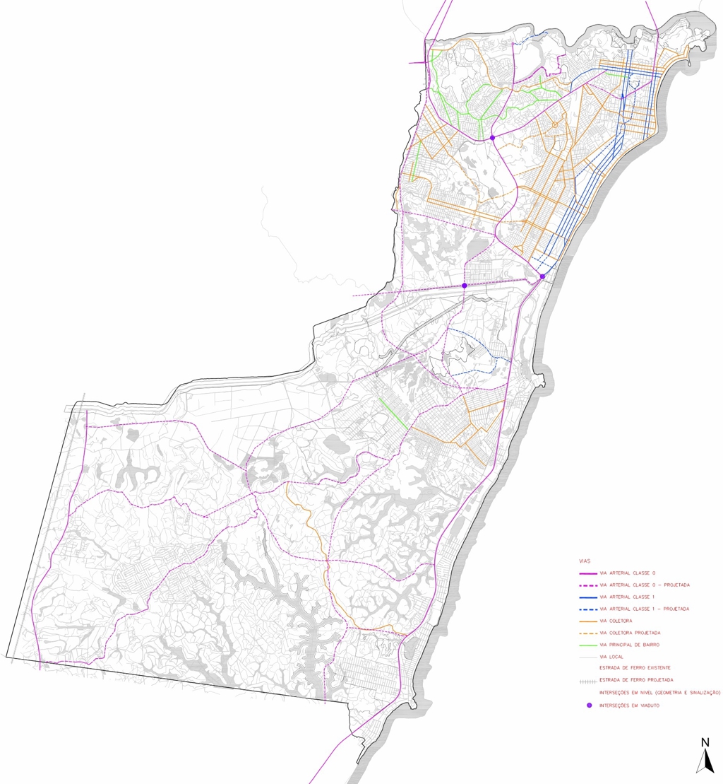 | 1,024 × 1,109 (451 KB) | LucFreitas (talk | contribs) | Adaptação de dados do Plano Diretor Municipal de Vila Velha, de 2007, que mostra a hierarquia viária oficial da cidade, como também as vias projetadas até a data de sua edição. Original em: http://www.cmvv.es.gov.br/exibir.aspx?pag=mapas |
You cannot overwrite this file.
File usage
The following page uses this file: