File:Brick lane cake diagram.png
Jump to navigation
Jump to search


Size of this preview: 726 × 600 pixels. Other resolutions: 291 × 240 pixels | 581 × 480 pixels | 884 × 730 pixels.
Original file (884 × 730 pixels, file size: 667 KB, MIME type: image/png)
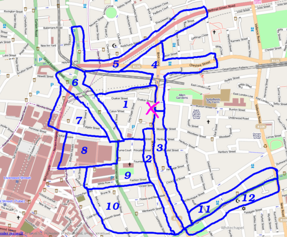
Cake diagram for the Brick Lane meet-up (London/Summer 2009 Mapping Party Marathon) 17th Aug 2009
Attendees
This is the sign-up list include who planned to map which slices
- Harry Wood - Slice 12
- TomH - Slice 10
- Ollie - Slice 5
- Firefishy - Slice 8
- Vance - Slice 7
- Matt - no slice. already have way too big a back-log!
- amm - Slice 6
- Markh - Slice 4 (was Slice 11)
- Hi Mark. This slice is quite well mapped already map, but you can always double-check things, or venture north onto Montague St. -- Harry Wood
- I'll do slice 4 instead then
- Thomas Wood - slice 9 will do nicely, may start mapping a bit late due to a conflicting event
- Wynndale - slice 3
File history
Click on a date/time to view the file as it appeared at that time.
| Date/Time | Thumbnail | Dimensions | User | Comment | |
|---|---|---|---|---|---|
| current | 13:25, 10 August 2009 | | 884 × 730 (667 KB) | Harry Wood (talk | contribs) | Cake diagram for the Brick Lane meet-up (London/Summer 2009 Mapping Party Marathon) |
You cannot overwrite this file.
File usage
There are no pages that use this file.