File:Building Footprint Digitization.png
Jump to navigation
Jump to search

Size of this preview: 800 × 566 pixels. Other resolutions: 320 × 226 pixels | 640 × 453 pixels | 1,024 × 724 pixels | 1,280 × 905 pixels | 2,560 × 1,810 pixels | 3,507 × 2,480 pixels.
Original file (3,507 × 2,480 pixels, file size: 799 KB, MIME type: image/png)
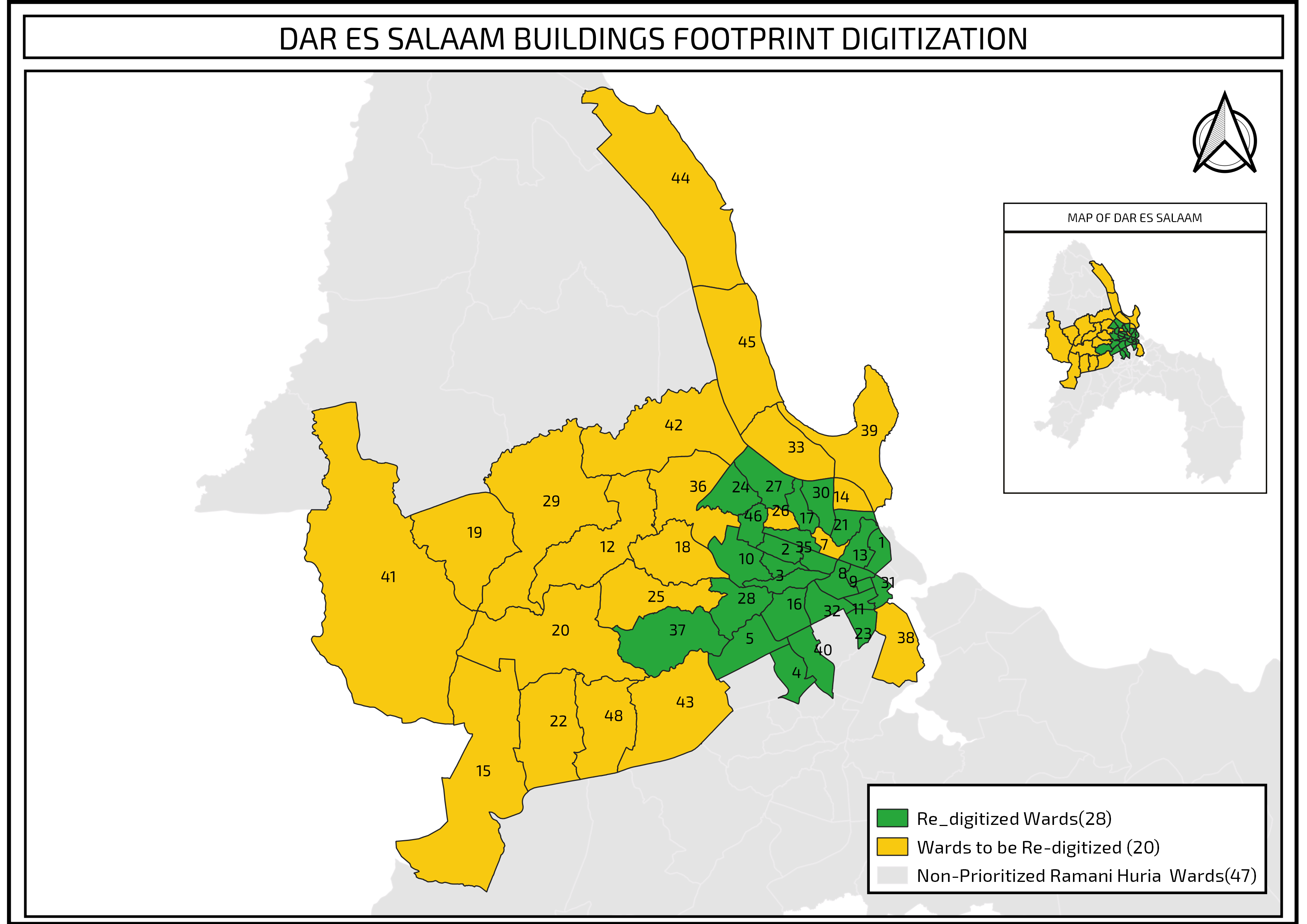
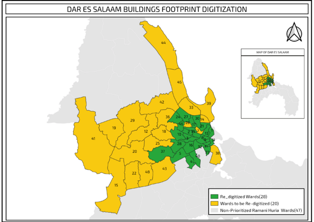
re-digitized wards in the building footprint digitization[1]
![]()
![]()
This work is licensed under the Creative Commons Attribution 4.0 License.
Attribution: Immaculate Mwanja
Attribution: Immaculate Mwanja
- ↑ CC-By 4.0 - I made this map for the Ramani Huria project.
File history
Click on a date/time to view the file as it appeared at that time.
| Date/Time | Thumbnail | Dimensions | User | Comment | |
|---|---|---|---|---|---|
| current | 13:30, 8 October 2019 | | 3,507 × 2,480 (799 KB) | Immaculate Mwanja (talk | contribs) |
You cannot overwrite this file.
File usage
The following page uses this file: