File:Building CT progress full res2.gif
Jump to navigation
Jump to search

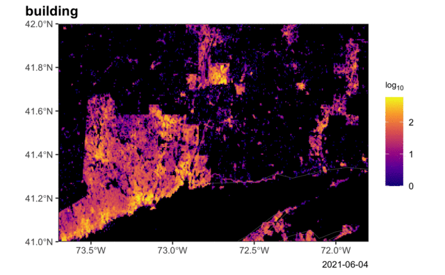
Size of this preview: 800 × 495 pixels. Other resolutions: 320 × 198 pixels | 640 × 396 pixels | 1,024 × 633 pixels | 1,280 × 791 pixels | 1,800 × 1,113 pixels.
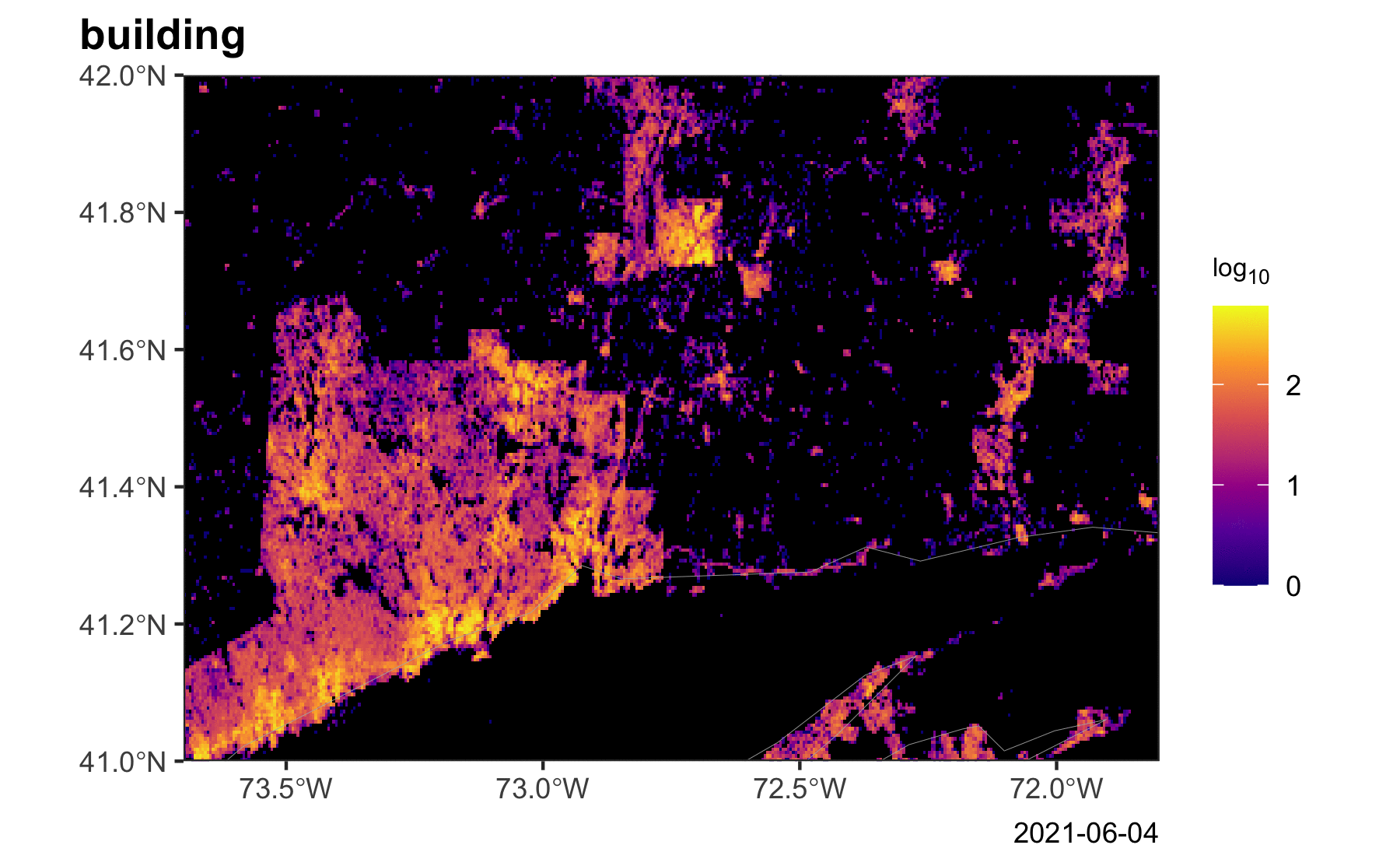
Original file (1,800 × 1,113 pixels, file size: 6.37 MB, MIME type: image/gif, looped, 80 frames, 9.9 s)
Note: Due to technical limitations, thumbnails of high resolution GIF images such as this one will not be animated.
Summary
Progress of building import in Connecticut, USA. Color scale shows building objects density in log10 scale. Created with get_tag_desity_map.sh https://github.com/ZeLonewolf/osm-overpass-scripts#get_tag_density_mapsh). Gif compiled with ImageMagick.
Licensing
![]()
I, the creator of this work, hereby release it into the public domain. This applies worldwide.
In case this is not legally possible, I grant anyone the right to use this work for any purpose, without any conditions, unless such conditions are required by law.
Notice to creator or uploader: Please consider using {{CC0-self}} instead for your work.
"Releasing work to public domain" has some issues, as it is not well defined in some jurisdictions and/or it is not actually possible to "release to public domain". Using CC0 license achieves the intended effect while avoiding such problems and is well suited for media files.
File history
Click on a date/time to view the file as it appeared at that time.
| Date/Time | Thumbnail | Dimensions | User | Comment | |
|---|---|---|---|---|---|
| current | 11:10, 9 April 2022 | | 1,800 × 1,113 (6.37 MB) | Mashin (talk | contribs) | Progress of building import in Connecticut, USA. Color scale shows building objects density in log10 scale. Created with get_tag_desity_map.sh https://github.com/ZeLonewolf/osm-overpass-scripts#get_tag_density_mapsh). Gif compiled with ImageMagick. |
You cannot overwrite this file.
File usage
There are no pages that use this file.