File:Calgary bus stop vector Jan 2022.svg
Jump to navigation
Jump to search


Size of this PNG preview of this SVG file: 600 × 600 pixels. Other resolutions: 240 × 240 pixels | 480 × 480 pixels | 768 × 768 pixels | 1,024 × 1,024 pixels | 1,440 × 1,440 pixels.
Original file (SVG file, nominally 1,440 × 1,440 pixels, file size: 312 KB)
Summary
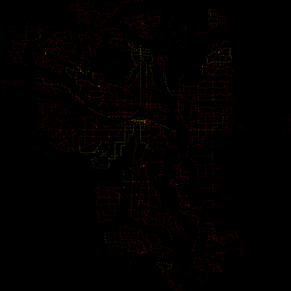
An svg map of all of the bus stops in Calgary. Green representing well mapped nodes, yellow representing mapped nodes, blue representing duplicate nodes, purple representing mapped nodes with a missing ref tag, and red nodes representing nodes that are considered missing.
The map is based on an ODBL - City of Calgary dataset, but with information derived from OpenStreetMap.
Licensing

This is a screenshot of free software; you can redistribute it and/or modify it under the terms of the GNU General Public License as published by the Free Software Foundation; either version 2 of the License, or any later version.
This work is distributed in the hope that it will be useful, but without any warranty; without even the implied warranty of merchantability or fitness for a particular purpose. See version 2 and version 3 of the GNU General Public License for more details. You should have received a copy of the GNU General Public License along with this program; if not, write to the Free Software Foundation, Inc., 51 Franklin St, Fifth Floor, Boston, MA 02110-1301 USA.
This work is distributed in the hope that it will be useful, but without any warranty; without even the implied warranty of merchantability or fitness for a particular purpose. See version 2 and version 3 of the GNU General Public License for more details. You should have received a copy of the GNU General Public License along with this program; if not, write to the Free Software Foundation, Inc., 51 Franklin St, Fifth Floor, Boston, MA 02110-1301 USA.
File history
Click on a date/time to view the file as it appeared at that time.
| Date/Time | Thumbnail | Dimensions | User | Comment | |
|---|---|---|---|---|---|
| current | 00:13, 28 January 2022 | | 1,440 × 1,440 (312 KB) | Lofenyy (talk | contribs) | Initially generated with all stops shown, including inactive ones. Turns out, inactive stops usually represent future bus stops, which aren't essential for this project. |
| 10:01, 1 January 2022 |  | 1,440 × 1,440 (360 KB) | Lofenyy (talk | contribs) | Update: A bug in software caused some nodes to be falsely recognized as duplicates, and others to be falsely recognized as not containing a ref number. This new version fixes this issue. | |
| 08:20, 31 December 2021 |  | 1,440 × 1,440 (372 KB) | Lofenyy (talk | contribs) | An svg map of all of the bus stops in Calgary. Green representing well mapped nodes, yellow representing mapped nodes, blue representing duplicate nodes, purple representing mapped nodes with a missing ref tag, and red nodes representing nodes that are considered missing. The map is based on an ODBL - City of Calgary dataset, but with information derived from OpenStreetMap. |
You cannot overwrite this file.
File usage
There are no pages that use this file.