File:CassavaWAfrica2.png
Jump to navigation
Jump to search


Size of this preview: 800 × 488 pixels. Other resolutions: 320 × 195 pixels | 640 × 391 pixels | 1,024 × 625 pixels | 1,535 × 937 pixels.
Original file (1,535 × 937 pixels, file size: 1.38 MB, MIME type: image/png)
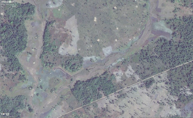
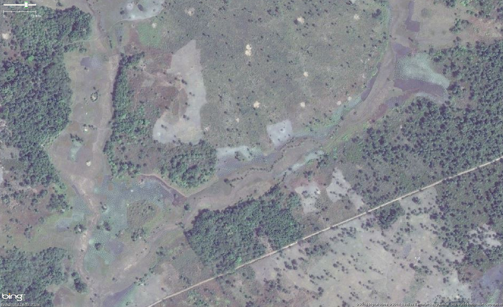
Aerial imagery of typical Cassava (Manioc) cultivation in West Africa.
This image is from a relatively zoomed out perspective and is meant to be viewed in the original full resolution to see what the area looks like from a "higher" perspective.
![]()
![]()
This image is composed entirely, or almost entirely, of Bing aerial imagery.
Bing imagery is not open licensed, but is generously made available to the OpenStreetMap project for deriving open licensed map data in editors such as JOSM, iD or Vespucci. This upload is not covered by permission described at Bing Maps, as OSM Wiki cannot be interpreted as "editor application" and "We require you use access credentials to use the service and require use of transaction tracking and/or session tracking methods for all uses of the service" is not fulfilled.
This image is a relatively minor extract of the (worldwide) Bing imagery, used for illustrative purposes on the OpenStreetMap wiki, to help document ways of using and interpreting the imagery in the OpenStreetMap mapping process.
This image is a relatively minor extract of the (worldwide) Bing imagery, used for illustrative purposes on the OpenStreetMap wiki, to help document ways of using and interpreting the imagery in the OpenStreetMap mapping process.
File history
Click on a date/time to view the file as it appeared at that time.
| Date/Time | Thumbnail | Dimensions | User | Comment | |
|---|---|---|---|---|---|
| current | 14:15, 27 October 2014 | | 1,535 × 937 (1.38 MB) | Bgirardot (talk | contribs) | Aerial imagery of typical Cassava (Manioc) cultivation in West Africa. {{Bing image}} |
You cannot overwrite this file.
File usage
The following page uses this file: