File:Collaborative Map of urban accessibility.pdf
Jump to navigation
Jump to search

Size of this JPG preview of this PDF file: 448 × 599 pixels. Other resolutions: 179 × 240 pixels | 359 × 480 pixels | 574 × 768 pixels | 765 × 1,024 pixels | 1,531 × 2,048 pixels | 4,545 × 6,081 pixels.
Original file (4,545 × 6,081 pixels, file size: 1.88 MB, MIME type: application/pdf)
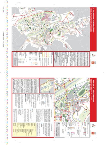
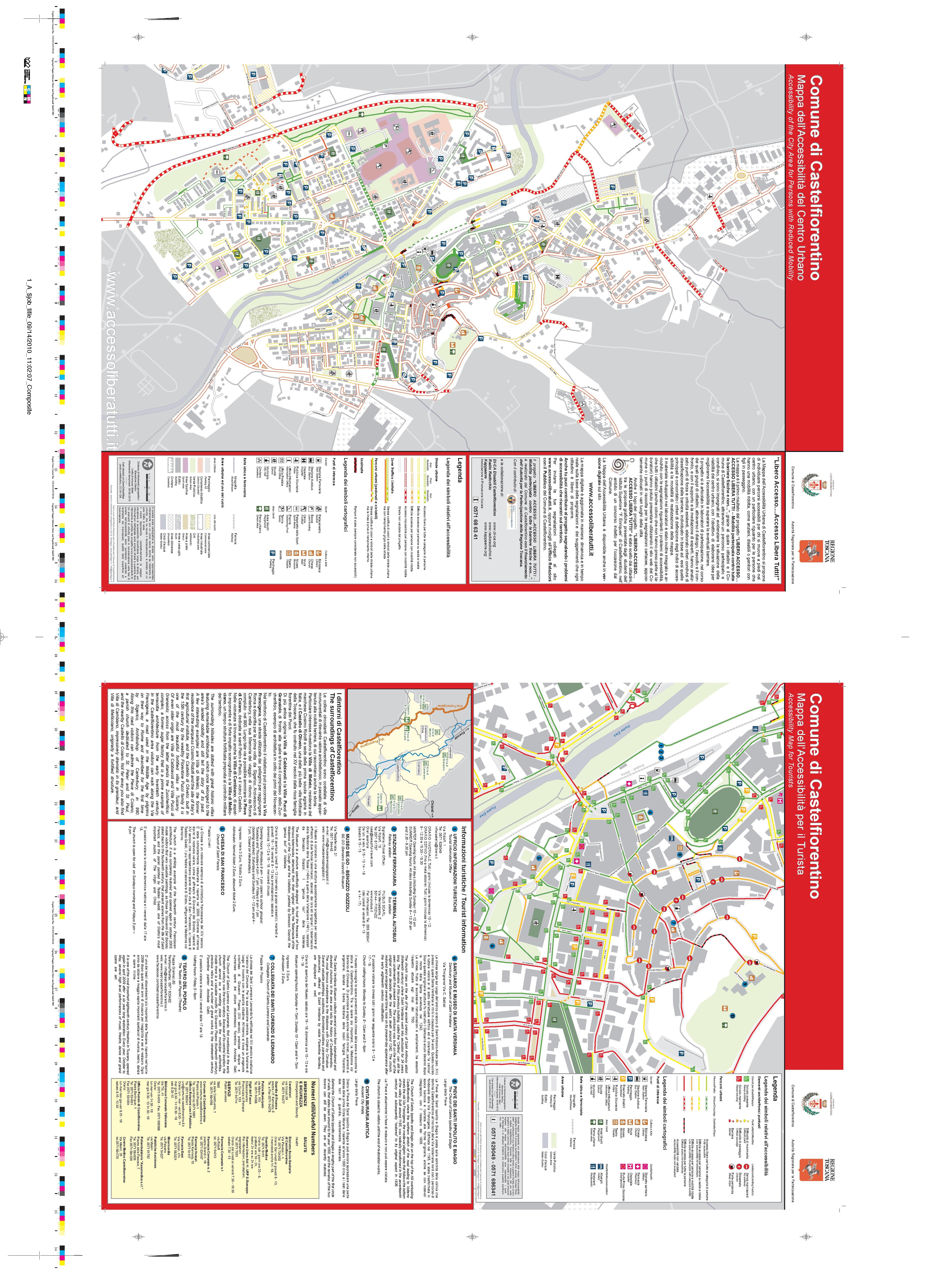
Printed paper map showing the results of the participatory process "Libero Accesso...accesso libera tutti!!" aimed at making of a collaborative map of urban accessibility in Castelfiorentino (Italy).
File history
Click on a date/time to view the file as it appeared at that time.
| Date/Time | Thumbnail | Dimensions | User | Comment | |
|---|---|---|---|---|---|
| current | 08:49, 19 October 2010 |  | 4,545 × 6,081 (1.88 MB) | Gadenz (talk | contribs) | Printed paper map showing the results of the participatory process "Libero Accesso...accesso libera tutti!!" aimed at making of a collaborative map of urban accessibility in Castelfiorentino (Italy). |
You cannot overwrite this file.
File usage
There are no pages that use this file.