File:Daoulas-1.jpg
Jump to navigation
Jump to search


Size of this preview: 800 × 583 pixels. Other resolutions: 320 × 233 pixels | 640 × 466 pixels | 1,024 × 746 pixels | 1,144 × 833 pixels.
Original file (1,144 × 833 pixels, file size: 353 KB, MIME type: image/jpeg)
Summary
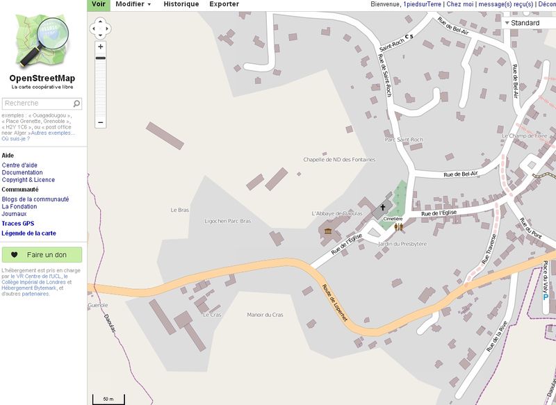
Etat de la carte avant le début des travaux | Abbaye de Daoulas
Licensing
| Contains map data © OpenStreetMap contributors, made available under the terms of the Open Database License (ODbL).
The ODbL does not require any particular license for maps produced from ODbL data, produced maps may be subject also to other licences. |
File history
Click on a date/time to view the file as it appeared at that time.
| Date/Time | Thumbnail | Dimensions | User | Comment | |
|---|---|---|---|---|---|
| current | 22:31, 17 November 2012 | | 1,144 × 833 (353 KB) | 1piedsurTerre (talk | contribs) | Etat de la carte avant le début des travaux | Abbaye de Daoulas |
You cannot overwrite this file.
File usage
The following page uses this file: