File:Fareham2.png
Jump to navigation
Jump to search


Size of this preview: 800 × 426 pixels. Other resolutions: 320 × 170 pixels | 640 × 341 pixels | 1,232 × 656 pixels.
Original file (1,232 × 656 pixels, file size: 508 KB, MIME type: image/png)
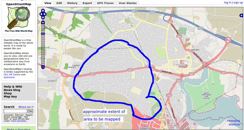
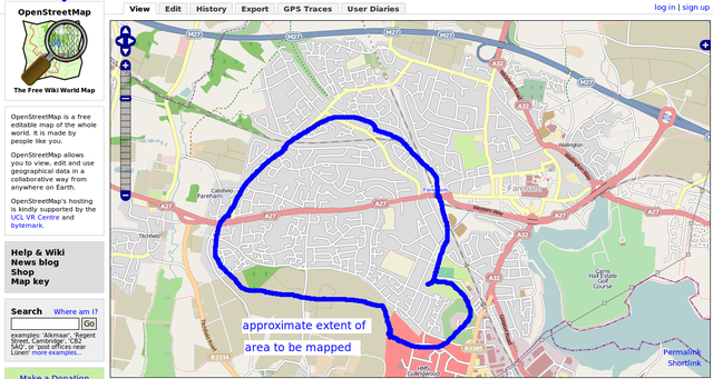
Fareham map for mapping party showing area to be mapped
File history
Click on a date/time to view the file as it appeared at that time.
| Date/Time | Thumbnail | Dimensions | User | Comment | |
|---|---|---|---|---|---|
| current | 08:26, 31 October 2009 | | 1,232 × 656 (508 KB) | Nickw (talk | contribs) | Fareham map for mapping party showing area to be mapped |
| 08:22, 31 October 2009 | 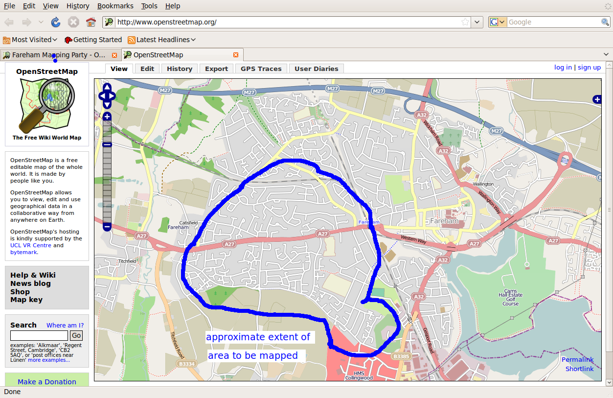 | 1,253 × 813 (537 KB) | Nickw (talk | contribs) | Fareham map for mapping party showing area to be mapped |
You cannot overwrite this file.
File usage
The following page uses this file: