File:Flowchart wetland RU.png
Jump to navigation
Jump to search

Size of this preview: 800 × 517 pixels. Other resolutions: 320 × 207 pixels | 640 × 414 pixels | 1,024 × 662 pixels | 1,280 × 828 pixels | 2,648 × 1,712 pixels.
Original file (2,648 × 1,712 pixels, file size: 435 KB, MIME type: image/png)
Summary
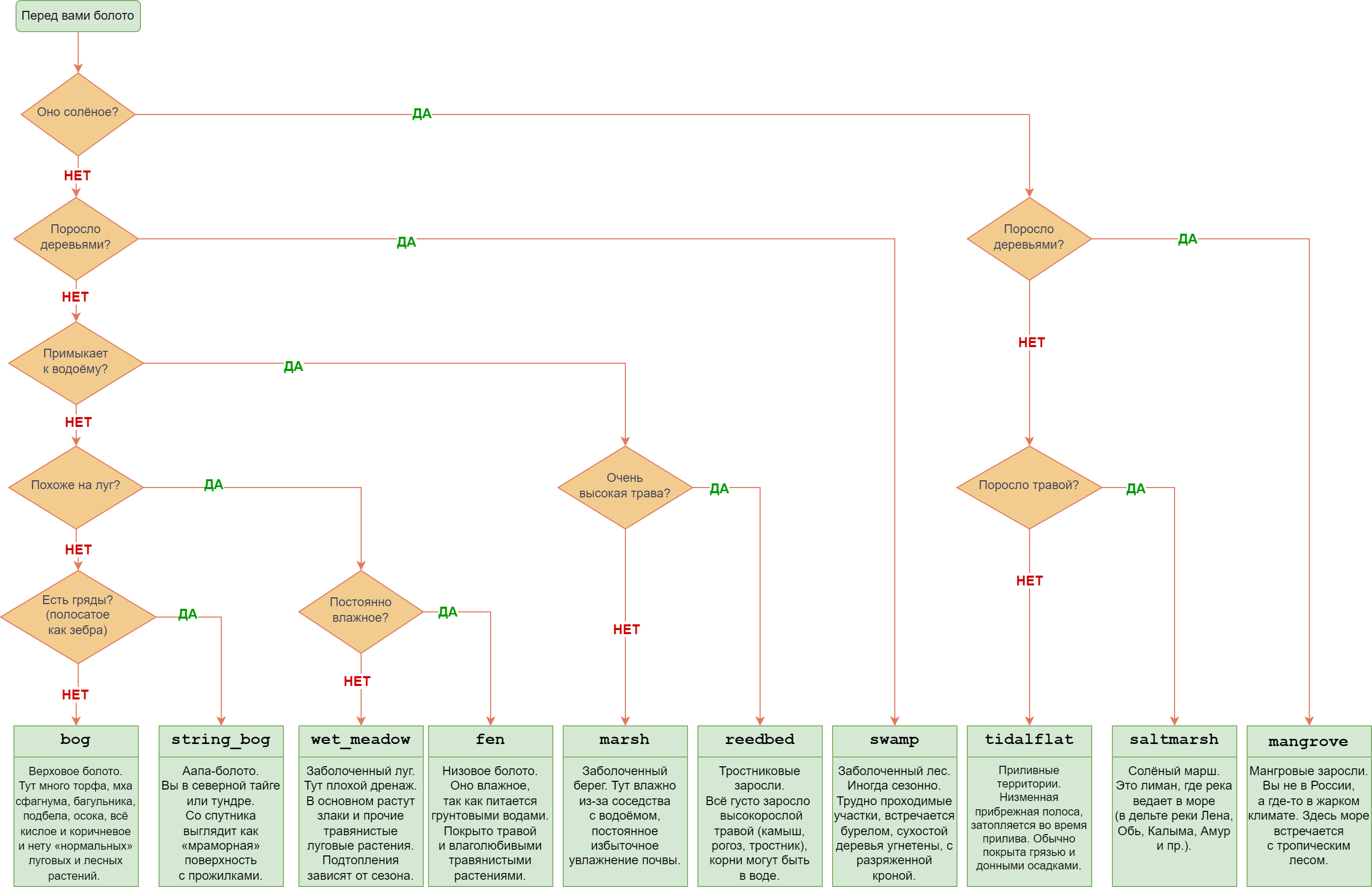
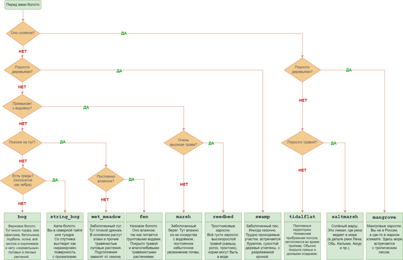
| Description | алгоритм определения тега для описания болот |
|---|---|
| Author | Afanasovich |
| Source | own |
| Date | 2024-09-06 |
| Other versions | File:Flowchart wetland RU.svg |
Licensing
![]()
![]()
This work is licensed under the Creative Commons Attribution 4.0 License.
Attribution: Afanasovich
Attribution: Afanasovich
File history
Click on a date/time to view the file as it appeared at that time.
| Date/Time | Thumbnail | Dimensions | User | Comment | |
|---|---|---|---|---|---|
| current | 15:09, 6 September 2024 | | 2,648 × 1,712 (435 KB) | Afanasovich (talk | contribs) | исправлены опечатки, уточнения в формулировках |
| 13:15, 6 September 2024 | 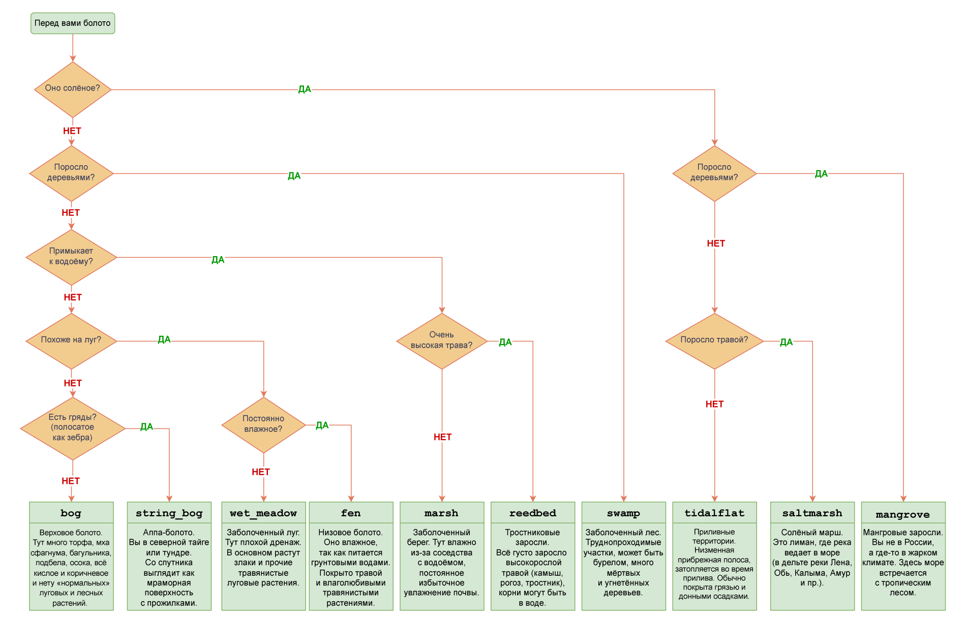 | 1,900 × 1,228 (225 KB) | Afanasovich (talk | contribs) | {{Information | description= алгоритм определения тега для описания болот | source= own | date= 2024-09-06 | author= Afanasovich | other_versions= File:Flowchart wetland RU.svg }} |
You cannot overwrite this file.
File usage
The following page uses this file: