File:France Tag Volume Map.png
Jump to navigation
Jump to search

Size of this preview: 607 × 599 pixels. Other resolutions: 243 × 240 pixels | 486 × 480 pixels | 778 × 768 pixels | 1,037 × 1,024 pixels | 2,074 × 2,048 pixels | 6,300 × 6,220 pixels.
Original file (6,300 × 6,220 pixels, file size: 2.96 MB, MIME type: image/png)
Color-coded map of France which categorizes departments based on how many "waterway=riverbank" tags they contain.
This infographic was made by OSM user MapSpot.
![]()
![]()
![]()
This work is licensed under the Creative Commons Attribution-ShareAlike 4.0 License.
Attribution not specified as a parameter! THIS LICENSE ALWAYS REQUIRES ATTRIBUTION! Use {{CC-BY-SA-4.0|Attribution, typically name of author}} See Template:CC-BY-SA-4.0 for full description this template should be used.
Attribution not specified as a parameter! THIS LICENSE ALWAYS REQUIRES ATTRIBUTION! Use {{CC-BY-SA-4.0|Attribution, typically name of author}} See Template:CC-BY-SA-4.0 for full description this template should be used.
File history
Click on a date/time to view the file as it appeared at that time.
| Date/Time | Thumbnail | Dimensions | User | Comment | |
|---|---|---|---|---|---|
| current | 06:50, 3 November 2021 | | 6,300 × 6,220 (2.96 MB) | MapSpot (talk | contribs) | |
| 05:10, 30 October 2021 | 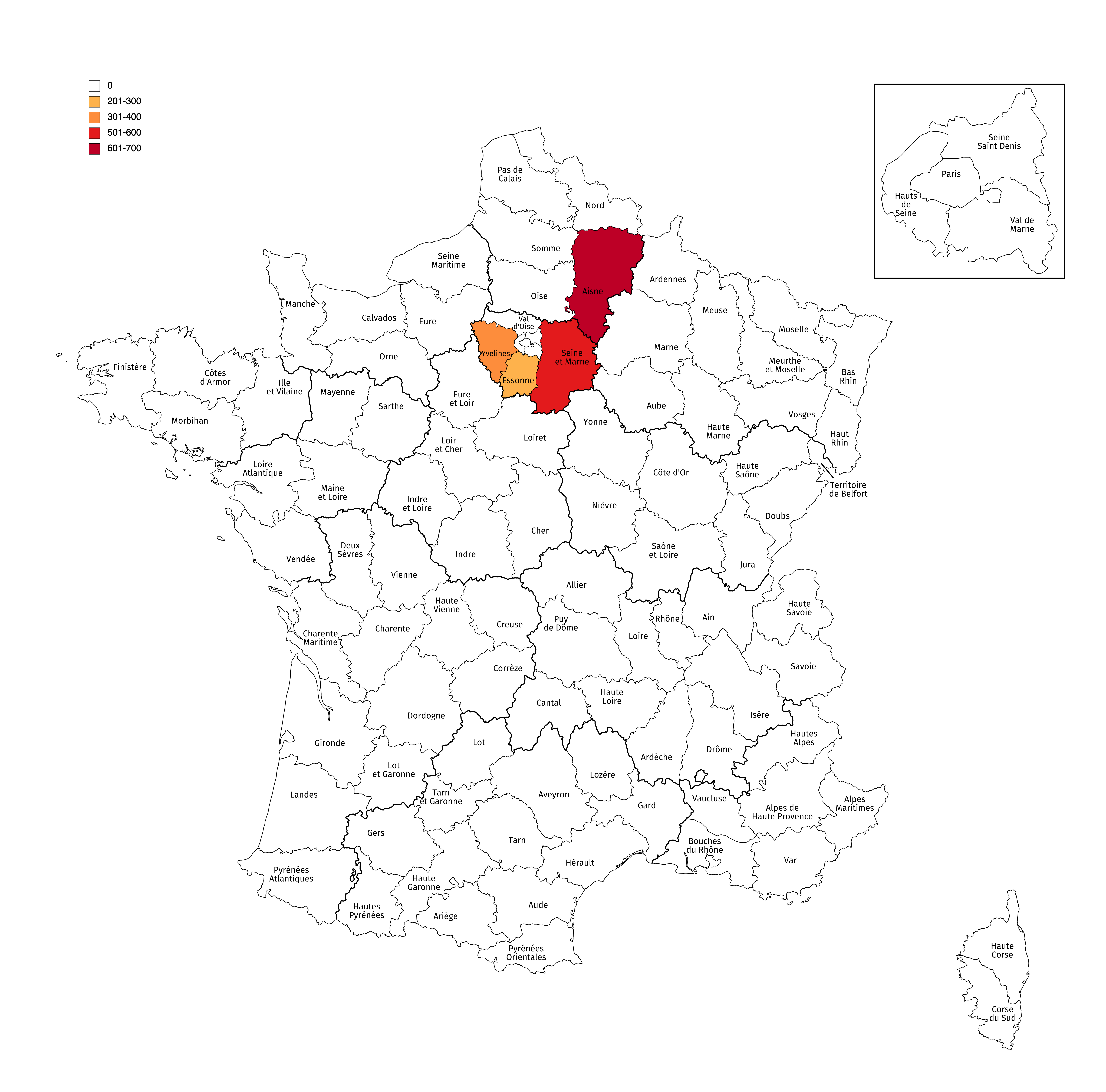 | 6,300 × 6,220 (3 MB) | MapSpot (talk | contribs) | ||
| 04:20, 29 October 2021 | 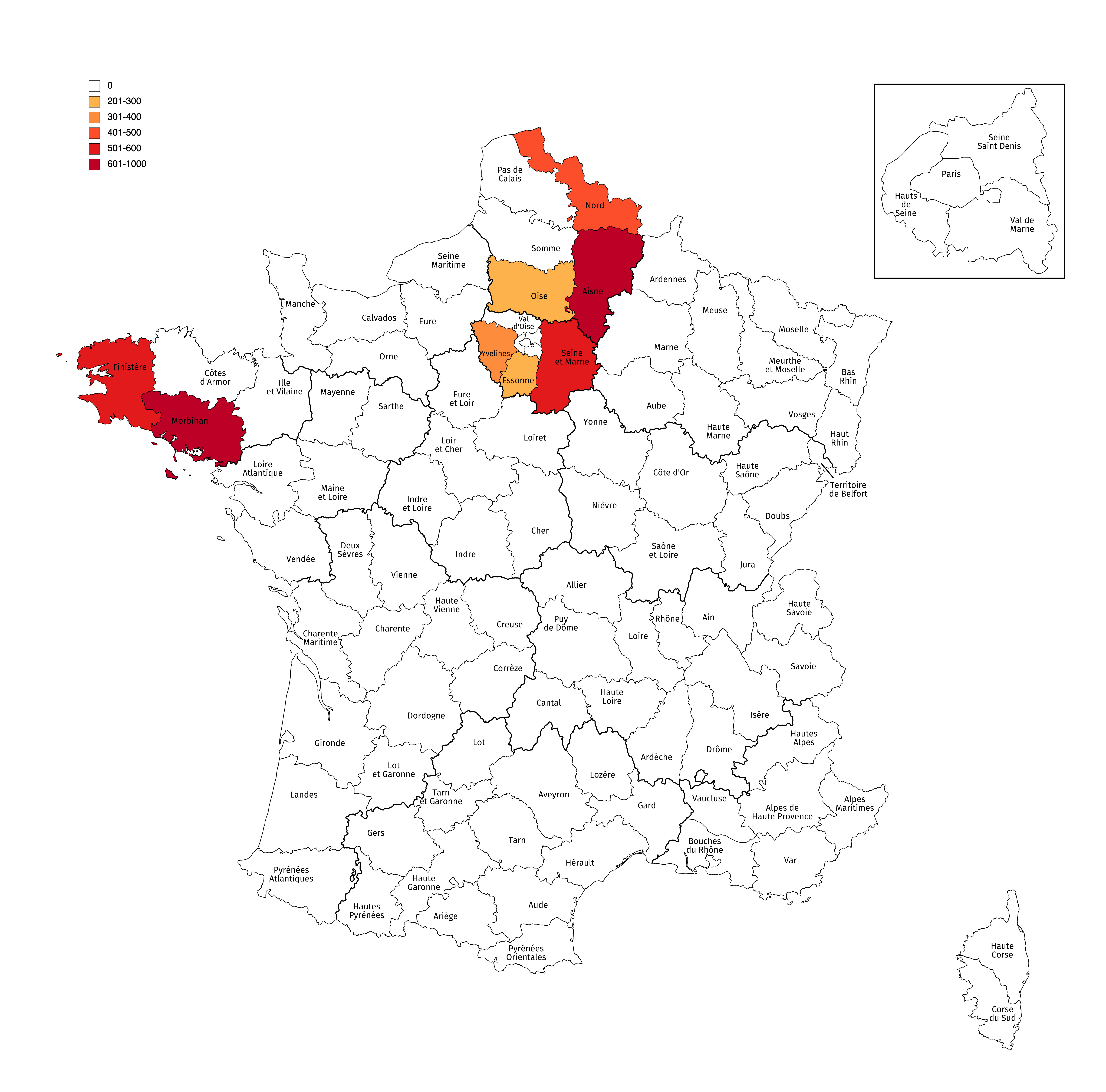 | 6,300 × 6,220 (3.03 MB) | MapSpot (talk | contribs) | ||
| 04:49, 26 October 2021 | 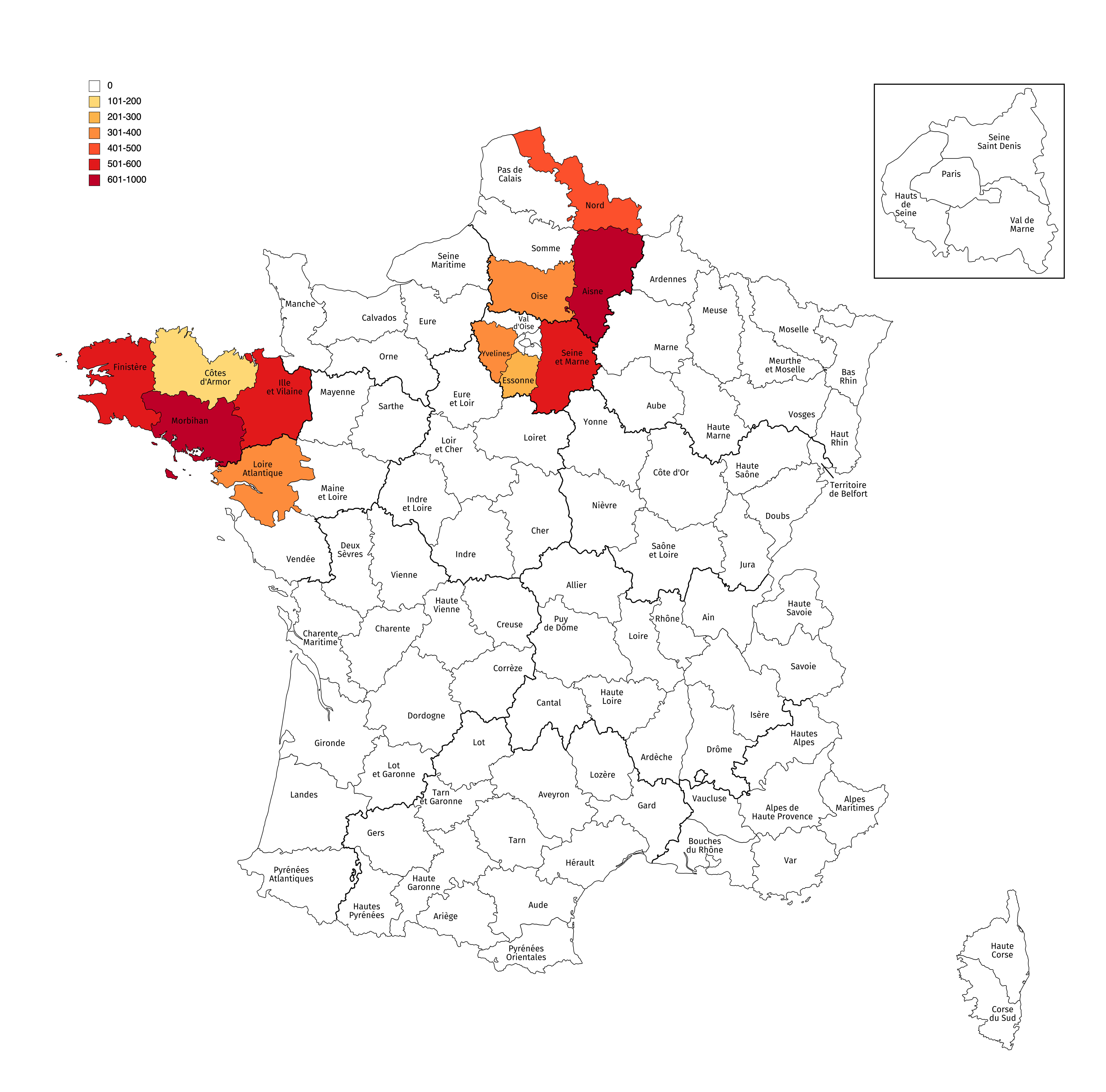 | 6,300 × 6,220 (3.06 MB) | MapSpot (talk | contribs) | ||
| 02:49, 21 October 2021 | 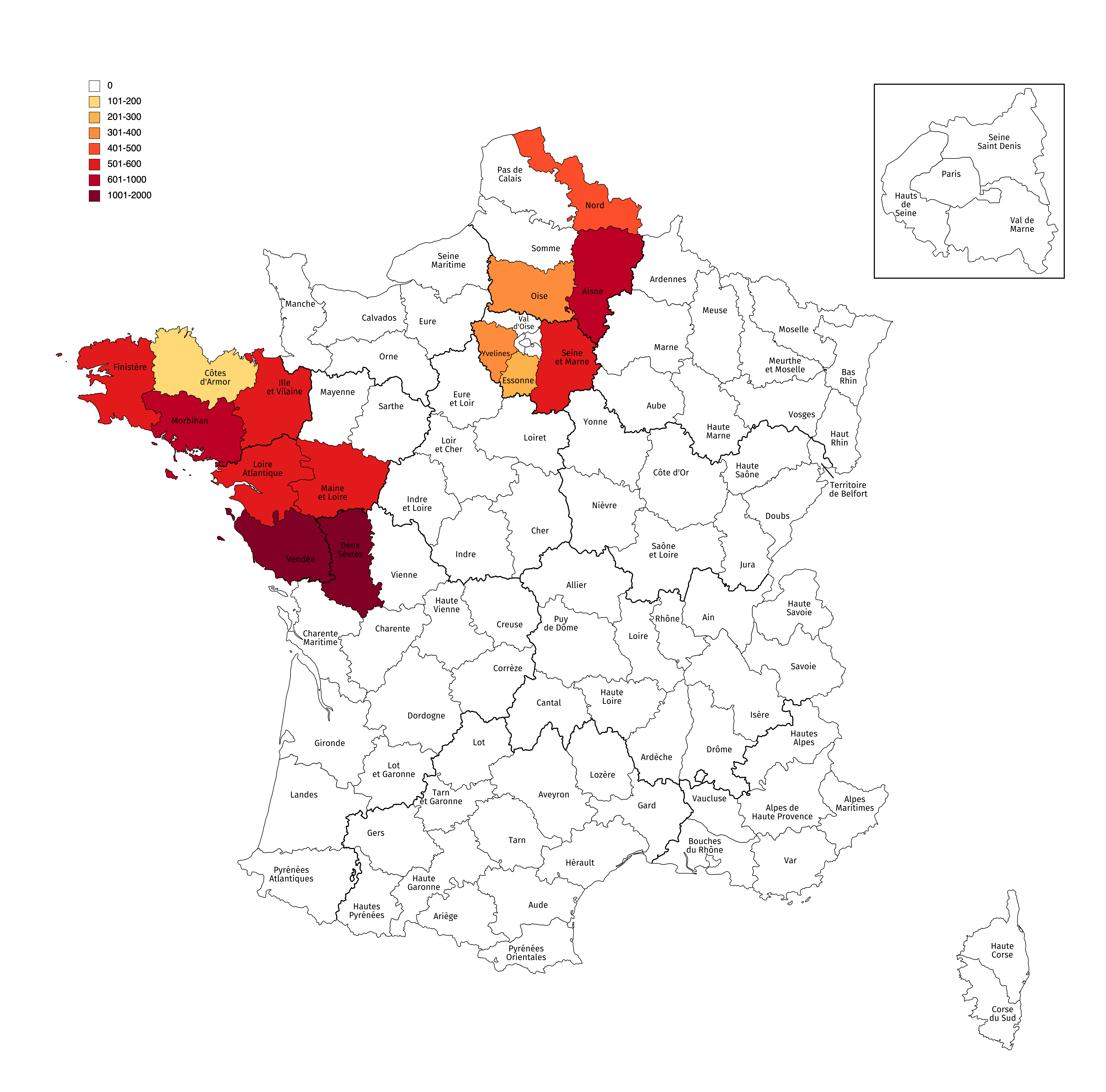 | 6,300 × 6,220 (3.07 MB) | MapSpot (talk | contribs) | ||
| 03:12, 16 October 2021 | 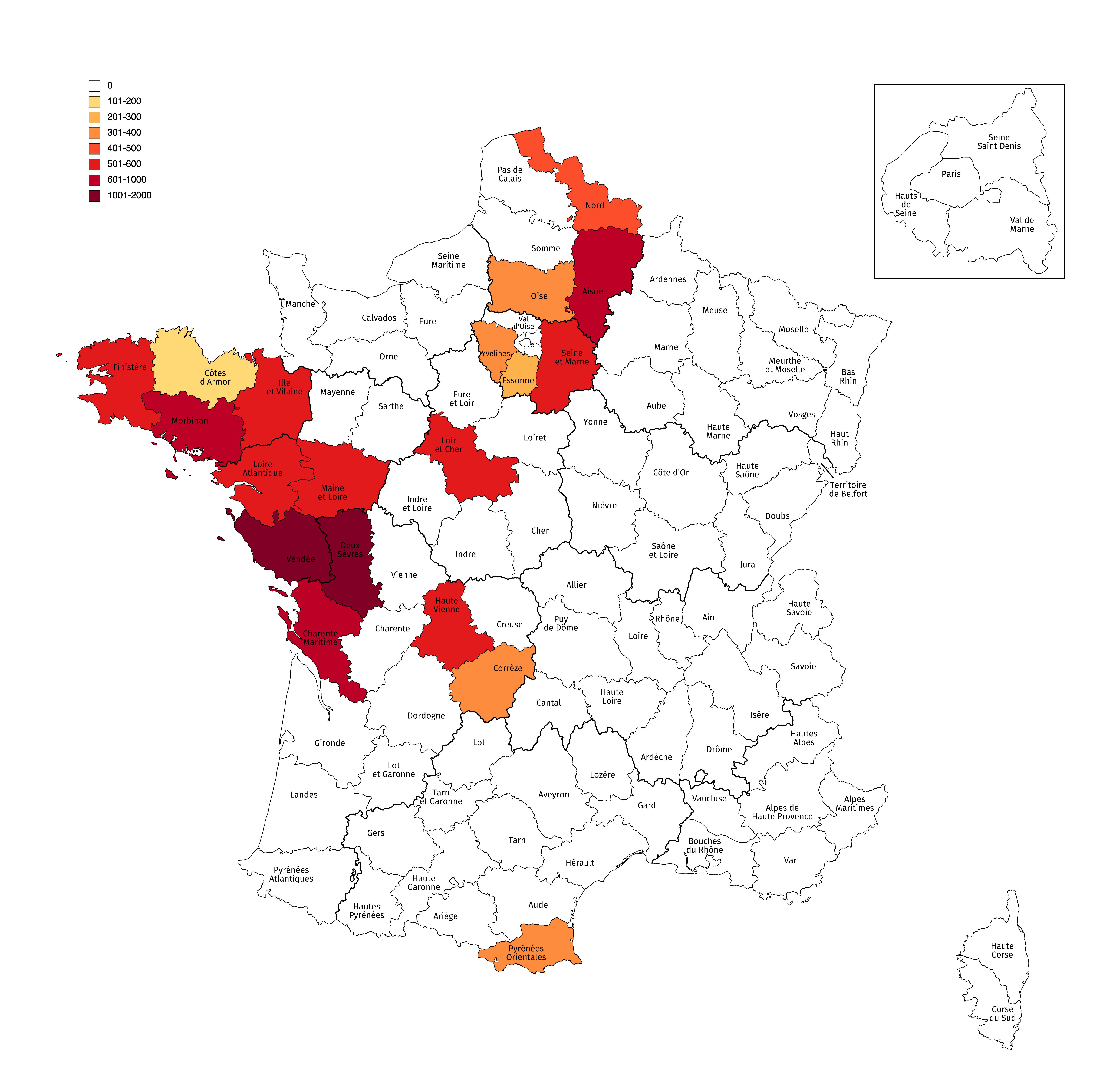 | 6,300 × 6,220 (3.09 MB) | MapSpot (talk | contribs) | ||
| 02:30, 14 October 2021 | 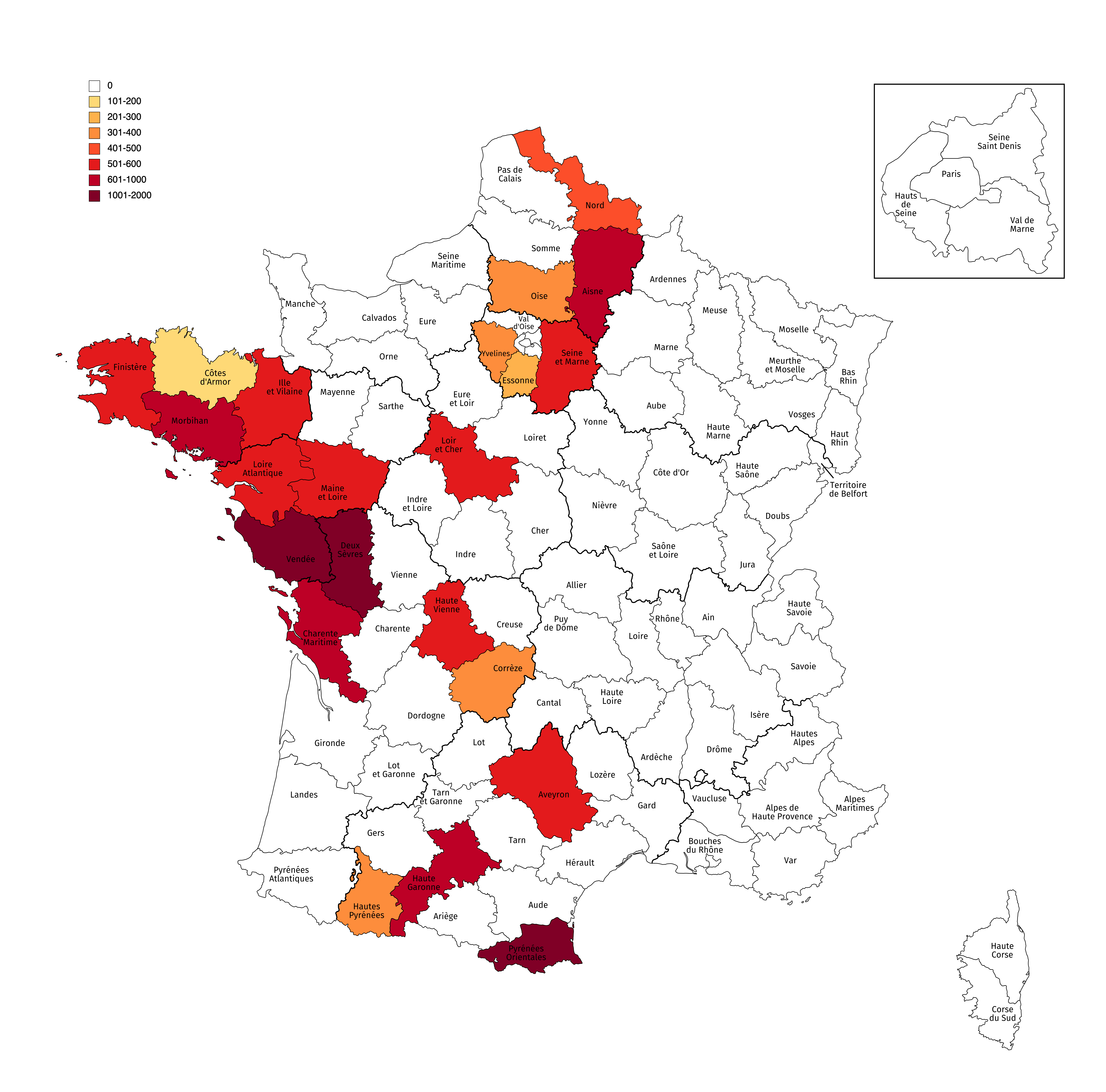 | 6,300 × 6,220 (3.1 MB) | MapSpot (talk | contribs) | ||
| 04:24, 8 October 2021 | 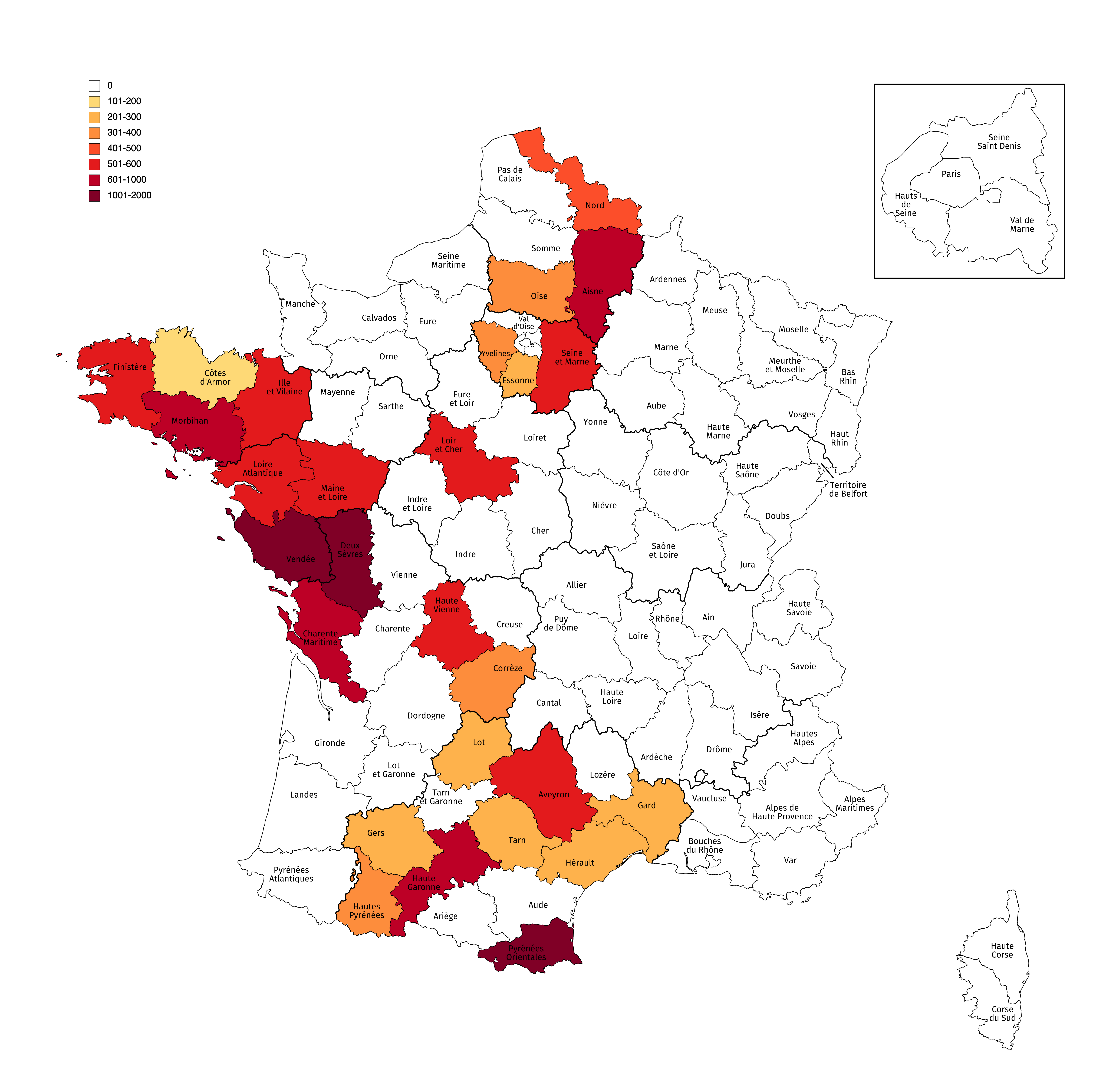 | 6,300 × 6,220 (3.13 MB) | MapSpot (talk | contribs) | ||
| 13:59, 6 October 2021 |  | 6,300 × 6,220 (3.15 MB) | MapSpot (talk | contribs) | ||
| 00:46, 30 September 2021 | 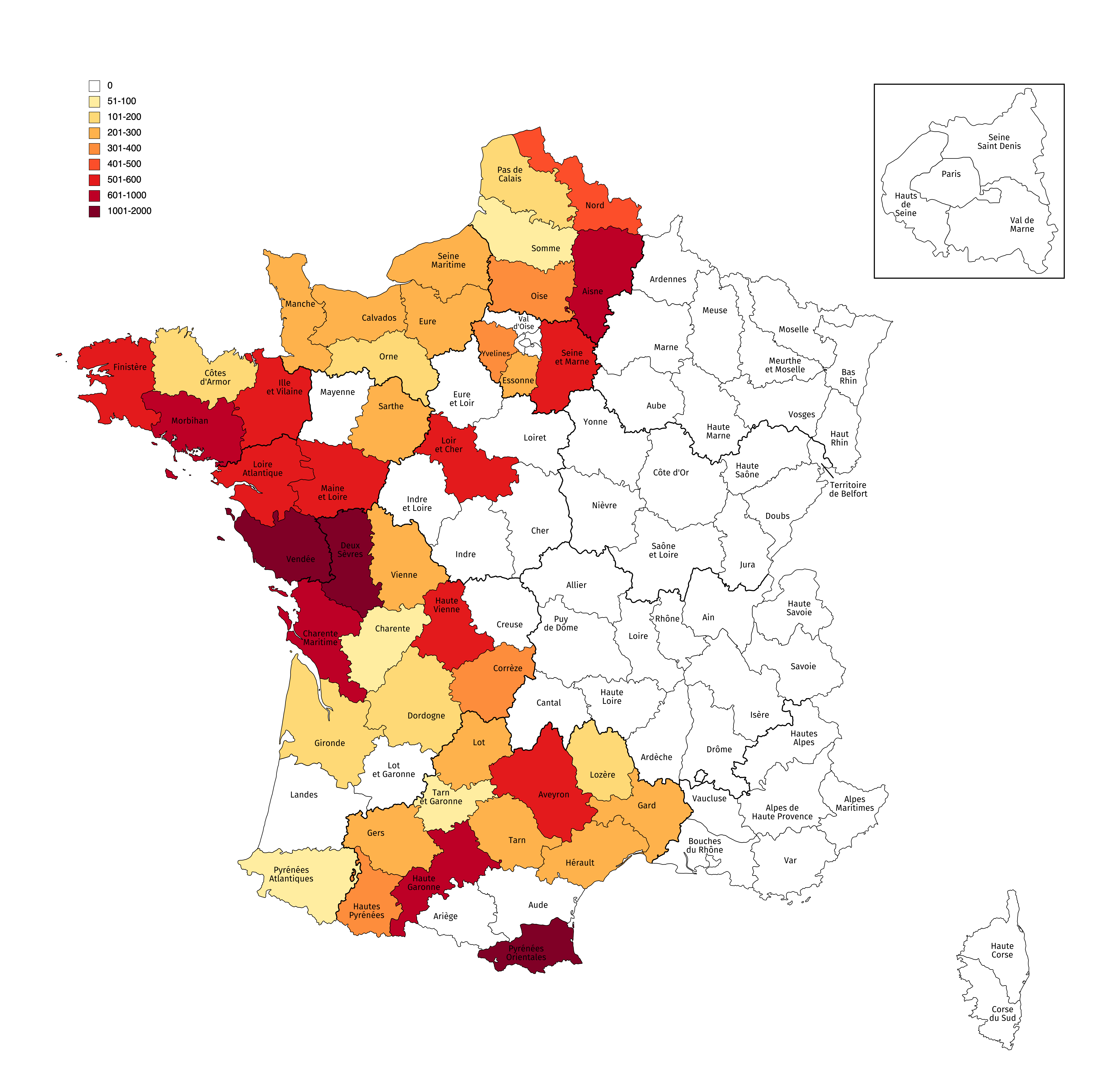 | 6,300 × 6,220 (3.19 MB) | MapSpot (talk | contribs) |
You cannot overwrite this file.
File usage
The following page uses this file: