File:GPSDeadZoneGPSDrive.png
Jump to navigation
Jump to search

No higher resolution available.
GPSDeadZoneGPSDrive.png (609 × 448 pixels, file size: 23 KB, MIME type: image/png)
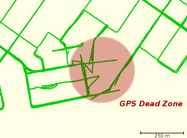
Area of bad GPS reception in Cambridge (Preston) Ontario Canada. Traces drawn in GPSDrive as received from Holux GM-210. Highlight added withthe GIMP.
File history
Click on a date/time to view the file as it appeared at that time.
| Date/Time | Thumbnail | Dimensions | User | Comment | |
|---|---|---|---|---|---|
| current | 02:00, 30 December 2006 | | 609 × 448 (23 KB) | Rw (talk | contribs) | Area of bad GPS reception in Cambridge (Preston) Ontario Canada. Traces drawn in GPSDrive as received from Holux GM-210. Highlight added withthe GIMP. |
You cannot overwrite this file.
File usage
The following 4 pages use this file: