File:I40 Greensboro Complex Connectivity.png
Jump to navigation
Jump to search


Size of this preview: 800 × 301 pixels. Other resolutions: 320 × 120 pixels | 640 × 241 pixels | 1,363 × 513 pixels.
Original file (1,363 × 513 pixels, file size: 1.44 MB, MIME type: image/png)
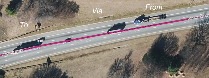
Image (with Public Domain NC Latest Orthoimagery background) of I40 in Greensboro, North Carolina, USA. Image is of this location: https://www.osm.org/#map=19/36.03428/-79.79996
File history
Click on a date/time to view the file as it appeared at that time.
| Date/Time | Thumbnail | Dimensions | User | Comment | |
|---|---|---|---|---|---|
| current | 15:28, 29 April 2019 | 1,363 × 513 (1.44 MB) | LeifRasmussen (talk | contribs) |
You cannot overwrite this file.
File usage
The following 3 pages use this file: