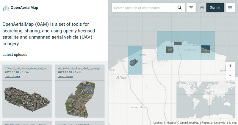
File:Imagery for Libya Floods activation on OpenAerialMap.png
Jump to navigation
Jump to search
Size of this preview: 800 × 423 pixels. Other resolutions: 320 × 169 pixels | 640 × 339 pixels | 1,045 × 553 pixels.
Original file (1,045 × 553 pixels, file size: 178 KB, MIME type: image/png)
Summary
| Description | Imagery for Libya Floods activation on OpenAerialMap |
|---|---|
| Author | |
| Source | OpenAerialMap |
| Date | 11 Oct 2023 |
Licensing
![]()
![]()
This work is licensed under the Creative Commons Attribution 4.0 License.
File history
Click on a date/time to view the file as it appeared at that time.
| Date/Time | Thumbnail | Dimensions | User | Comment | |
|---|---|---|---|---|---|
| current | 09:05, 11 October 2023 | | 1,045 × 553 (178 KB) | Pedrito1414 (talk | contribs) | {{Information | description=Imagery for Libya Floods activation on OpenAerialMap | source=OpenAerialMap | date=11 Oct 2023 | author= | other_versions= }} |
You cannot overwrite this file.
File usage
There are no pages that use this file.