File:JOSM shp v klm geo diff.png
Jump to navigation
Jump to search


Size of this preview: 800 × 450 pixels. Other resolutions: 320 × 180 pixels | 640 × 360 pixels | 1,024 × 576 pixels | 1,366 × 768 pixels.
Original file (1,366 × 768 pixels, file size: 116 KB, MIME type: image/png)
Summary
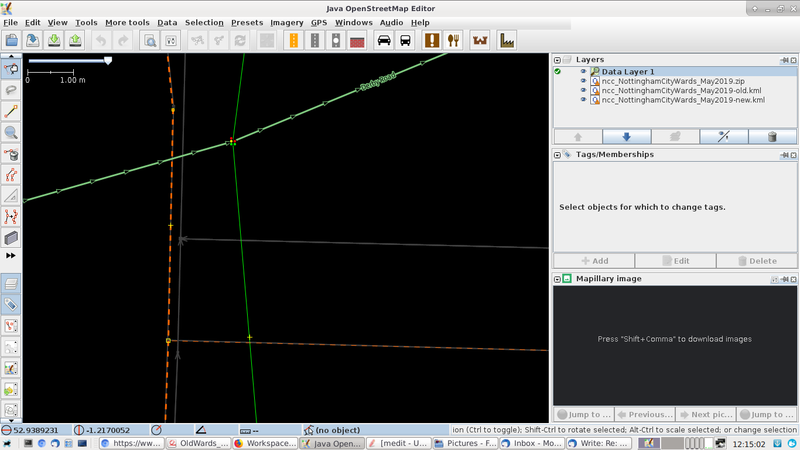
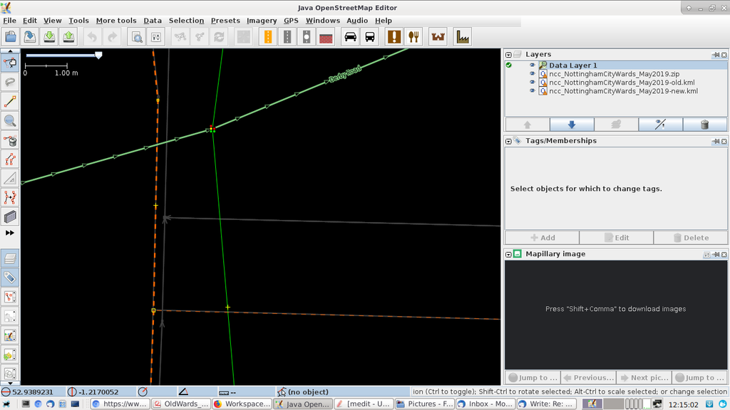
A screenshot to illustrate potential differences between ESRI Shapefile (underlies the dashed-brown boundary lines) and KLM file (grey lines) geometry. Both .shp & .klm files were produced from the same OS-boundary-line files, yet there is almost a 3cm difference in the N-S axis. Later processing by the author to produce a KLM file from the SHP fileset using ogr2ogr reduced that gap to ~2mm. See https://www.openstreetmap.org/user/alexkemp/diary/56390
Licensing
![]()
This file is a JOSM screenshot, without imagery in a background.
Some OSM data present, but not enough to be license-relevant.
![]()
"JOSM" (Java OpenStreetMap Editor – josm.openstreetmap.de) is free software released under the terms of the GNU General Public License as published by the Free Software Foundation; either version 2 of the license, or any later version.
File history
Click on a date/time to view the file as it appeared at that time.
| Date/Time | Thumbnail | Dimensions | User | Comment | |
|---|---|---|---|---|---|
| current | 15:50, 30 April 2019 | | 1,366 × 768 (116 KB) | Alexkemp (talk | contribs) | A screenshot to illustrate potential differences between ESRI Shapefile (underlies the dashed-brown boundary lines) and KLM file (grey lines) geometry. Both .shp & .klm files were produced from the same OS-boundary-line files, yet there is almost a 3cm... |
You cannot overwrite this file.
File usage
There are no pages that use this file.