File:LA2-taget.png
Jump to navigation
Jump to search

No higher resolution available.
LA2-taget.png (288 × 270 pixels, file size: 28 KB, MIME type: image/png)
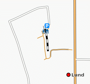
Screenshot of the Osmarender layer (from tiles@home), showing a detail of Lund, Sweden.
![]()
Contains map data © OpenStreetMap contributors, made available under the terms of the Creative Commons Attribution-ShareAlike 2.0 (CC-BY-SA-2.0).
File history
Click on a date/time to view the file as it appeared at that time.
| Date/Time | Thumbnail | Dimensions | User | Comment | |
|---|---|---|---|---|---|
| current | 00:10, 18 April 2007 | | 288 × 270 (28 KB) | LA2 (talk | contribs) | Screenshot of the Osmarender layer (from tiles@home), showing a detail of Lund, Sweden. |
You cannot overwrite this file.
File usage
The following page uses this file: