File:London borough boundaries 2008.png
(Redirected from File:London-borough-boundaries.png)
Jump to navigation
Jump to search

No higher resolution available.
London_borough_boundaries_2008.png (505 × 471 pixels, file size: 195 KB, MIME type: image/png)
Progress of boundary=administrative tagging in London as of October 2008.
This image is of historical interest only. For an up-to-date view of how the boundaries data is looking in London (it's looking much more finished!), use OSMInspector (permalink)
This image was originally created as follows:
Fetch this data with a Xapi query with this URL:
http://www.informationfreeway.org/api/0.5/*[boundary=administrative][bbox=-0.48,51.30,0.21,51.70]
~740Kb. give it a minute. Save the resulting XML file as a .osm file which you can open in JOSM.
![]()
Contains map data © OpenStreetMap contributors, made available under the terms of the Creative Commons Attribution-ShareAlike 2.0 (CC-BY-SA-2.0).
File history
Click on a date/time to view the file as it appeared at that time.
| Date/Time | Thumbnail | Dimensions | User | Comment | |
|---|---|---|---|---|---|
| current | 10:42, 29 September 2022 | | 505 × 471 (195 KB) | Harry Wood (talk | contribs) | Of course these days it's a bit more finished. I'm going to revert to a 2008 state because it's a more amusing historical artefact to use on the London borough boundaries page |
| 17:03, 20 July 2009 | 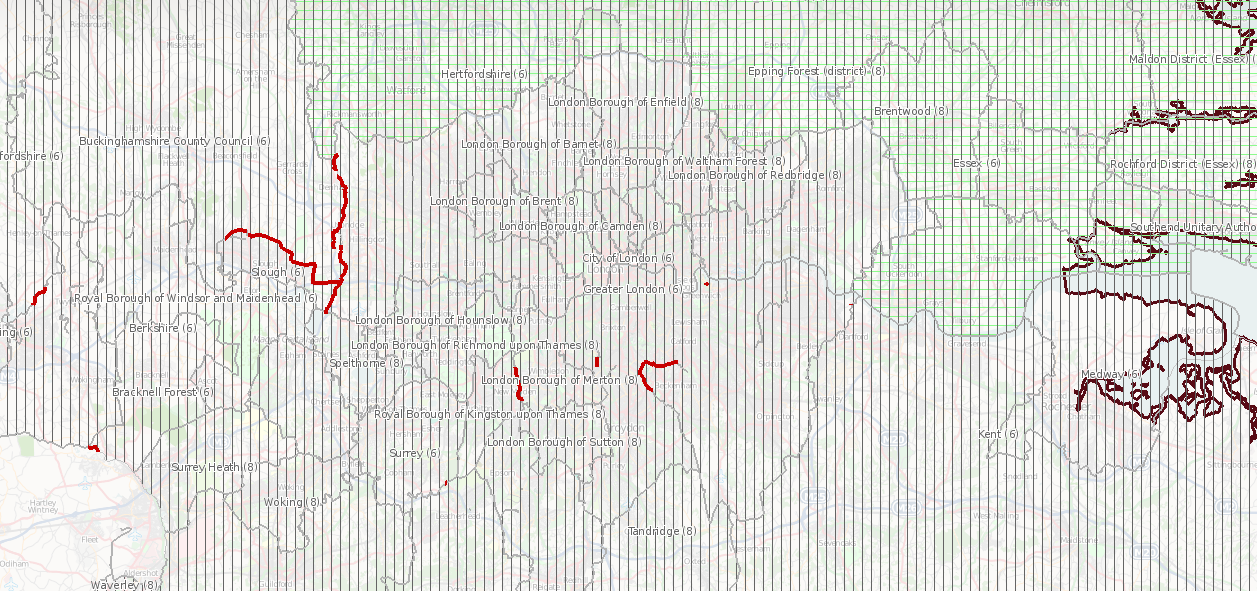 | 1,257 × 591 (821 KB) | Thomas Wood (talk | contribs) | New version, slightly wider view | |
| 17:30, 19 January 2009 | 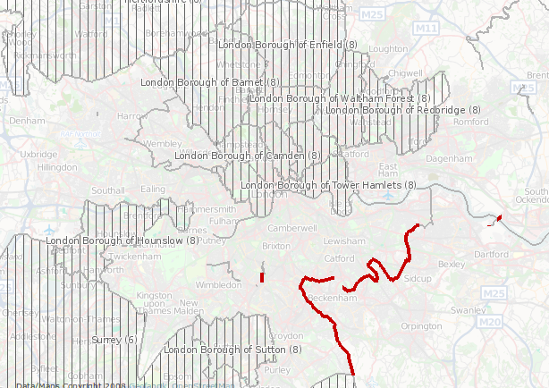 | 614 × 434 (323 KB) | Thomas Wood (talk | contribs) | ||
| 22:14, 20 December 2008 | 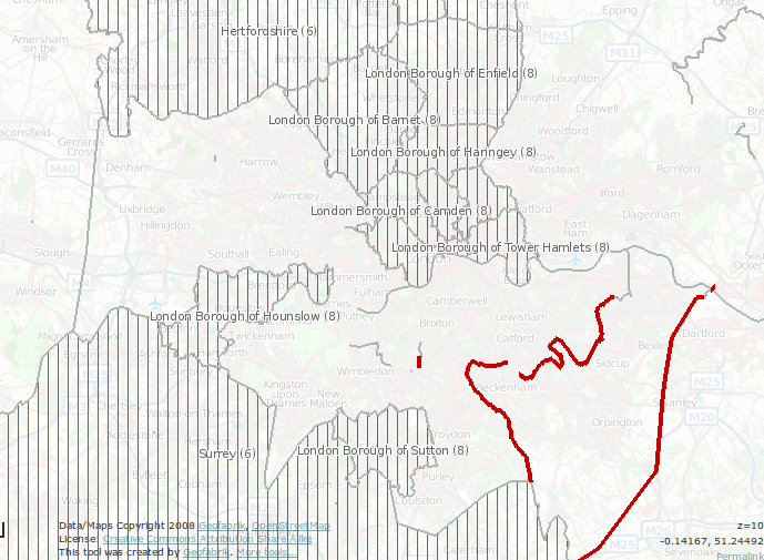 | 689 × 505 (425 KB) | Thomas Wood (talk | contribs) | ||
| 16:56, 17 November 2008 | 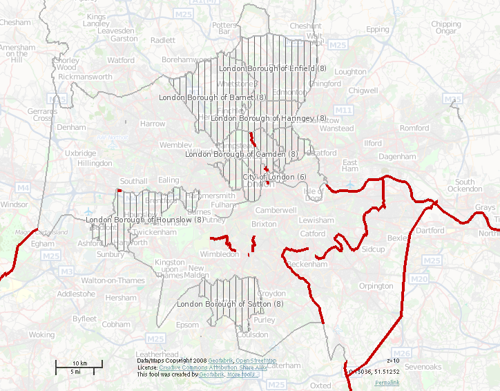 | 724 × 566 (500 KB) | Thomas Wood (talk | contribs) | New, shinier version from the OSM Inspector, although lacking the missing borough's names - a target to work for! Note: Tower Hamlets' relation is missing from this particular render, now fixed in data, along with (hopefully all) the remaining red-ma | |
| 21:45, 5 October 2008 | 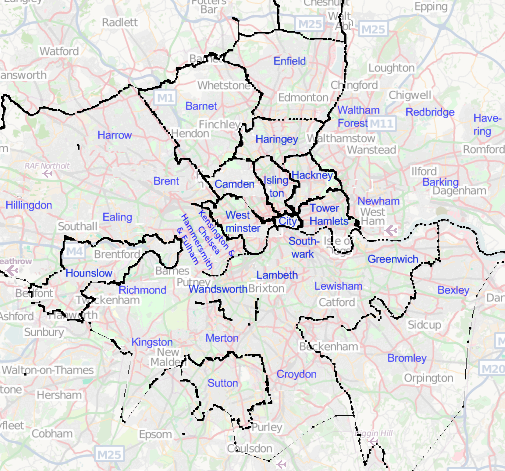 | 505 × 471 (195 KB) | Harry Wood (talk | contribs) | update with latest boundary data + cover slightly wider area | |
| 14:23, 2 May 2008 | 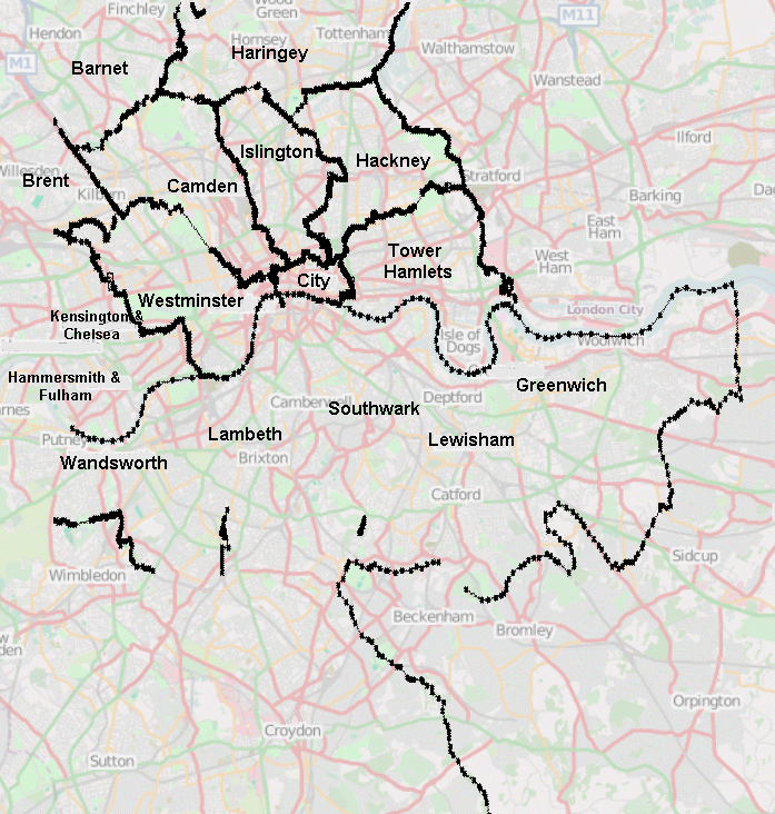 | 697 × 732 (522 KB) | Harry Wood (talk | contribs) | Progress of Tag:boundary=administrative in London (May 2008) |
You cannot overwrite this file.
File usage
The following 3 pages use this file: