File:Luxembourg-Admin Boundaries-Canton Clervaux.png
Jump to navigation
Jump to search

Size of this preview: 631 × 600 pixels. Other resolutions: 253 × 240 pixels | 505 × 480 pixels | 808 × 768 pixels | 1,078 × 1,024 pixels | 2,472 × 2,349 pixels.
Original file (2,472 × 2,349 pixels, file size: 347 KB, MIME type: image/png)
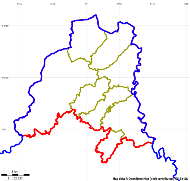
Administrative boundaries of the canton Clervaux
File history
Click on a date/time to view the file as it appeared at that time.
| Date/Time | Thumbnail | Dimensions | User | Comment | |
|---|---|---|---|---|---|
| current | 00:00, 11 January 2011 | | 2,472 × 2,349 (347 KB) | Loll78 (talk | contribs) | Administrative boundaries of the canton Clervaux (status 10-jan-2011) |
| 12:49, 6 January 2011 |  | 771 × 784 (66 KB) | Loll78 (talk | contribs) | Administrative boundaries of the canton Clervaux |
You cannot overwrite this file.
File usage
The following page uses this file: