File:Mbl.jpg
Jump to navigation
Jump to search

No higher resolution available.
Mbl.jpg (756 × 504 pixels, file size: 68 KB, MIME type: image/jpeg)
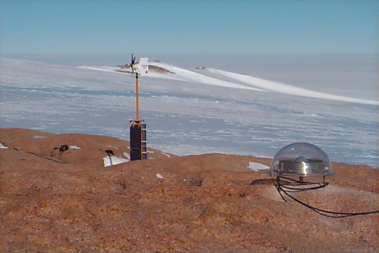
Remote GPS monitoring site at Nunatak east of Mount Carbone, Phillips Mountains, western Marie Byrd Land
Image Courtesy NASA/JPL-Caltech.
File history
Click on a date/time to view the file as it appeared at that time.
| Date/Time | Thumbnail | Dimensions | User | Comment | |
|---|---|---|---|---|---|
| current | 07:39, 20 May 2010 | | 756 × 504 (68 KB) | Delta foxtrot2 (talk | contribs) | Remote GPS monitoring site at Nunatak east of Mount Carbone, Phillips Mountains, western Marie Byrd Land Image Courtesy NASA/JPL-Caltech. |
You cannot overwrite this file.
File usage
The following 21 pages use this file:
- Cs:Key:monitoring:galileo
- Cs:Key:monitoring:glonass
- Cs:Key:monitoring:gps
- Cs:Tag:man made=monitoring station
- Key:monitoring:galileo
- Key:monitoring:glonass
- Key:monitoring:gps
- Pl:Tag:man made=monitoring station
- Pt:Tag:man made=monitoring station
- Tag:man made=monitoring station
- User:Mateusz Konieczny/notify uploaders/Delta foxtrot2
- Wiki:Files used by data items/3
- DE:Tag:man made=monitoring station
- FR:Tag:man made=monitoring station
- ES:Key:monitoring:galileo
- ES:Key:monitoring:glonass
- ES:Key:monitoring:gps
- ES:Tag:man made=monitoring station
- RU:Tag:man made=monitoring station
- JA:Key:monitoring:gps
- JA:Tag:man made=monitoring station