File:Melb bike lanes 2024-05-03.png
Jump to navigation
Jump to search

Size of this preview: 800 × 438 pixels. Other resolutions: 320 × 175 pixels | 640 × 351 pixels | 1,024 × 561 pixels | 1,590 × 871 pixels.
Original file (1,590 × 871 pixels, file size: 1.49 MB, MIME type: image/png)
| Contains map data © OpenStreetMap contributors, made available under the terms of the Open Database License (ODbL).
The ODbL does not require any particular license for maps produced from ODbL data, produced maps may be subject also to other licences. |
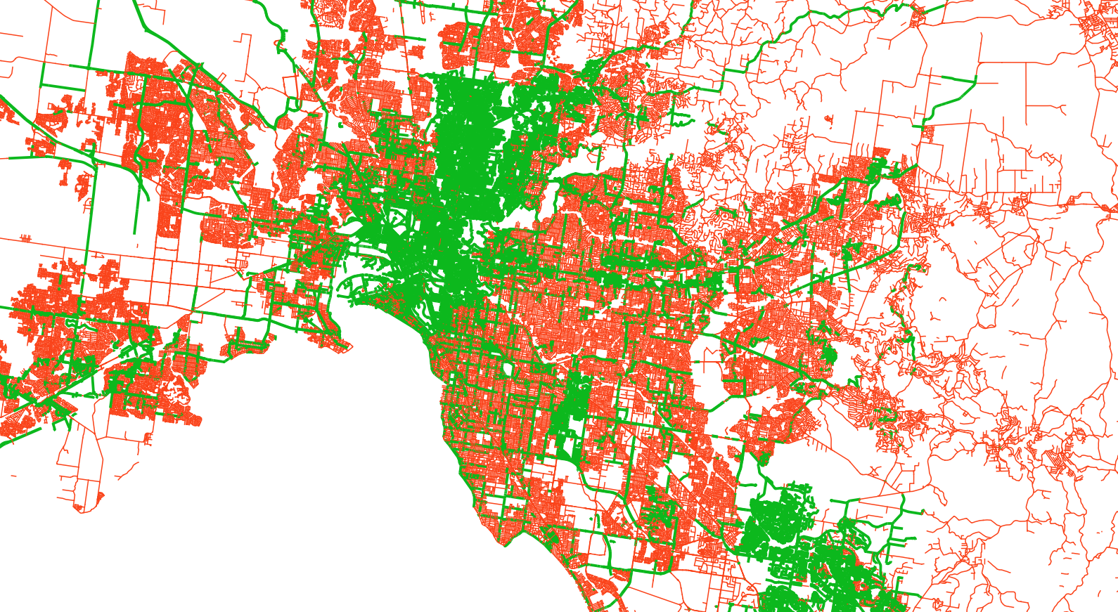
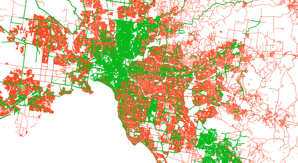
Extent of cycleway mapping in Melbourne, Australia. Green means bike lane information has been mapped (irrespective of bike lane existence), and red has not been mapped at all
File history
Click on a date/time to view the file as it appeared at that time.
| Date/Time | Thumbnail | Dimensions | User | Comment | |
|---|---|---|---|---|---|
| current | 00:27, 3 May 2024 | | 1,590 × 871 (1.49 MB) | Cs09736 (talk | contribs) |
You cannot overwrite this file.
File usage
The following page uses this file: