File:OSM交通运输地图.png
Jump to navigation
Jump to search

Size of this preview: 800 × 406 pixels. Other resolutions: 320 × 162 pixels | 640 × 325 pixels | 1,412 × 716 pixels.
Original file (1,412 × 716 pixels, file size: 441 KB, MIME type: image/png)
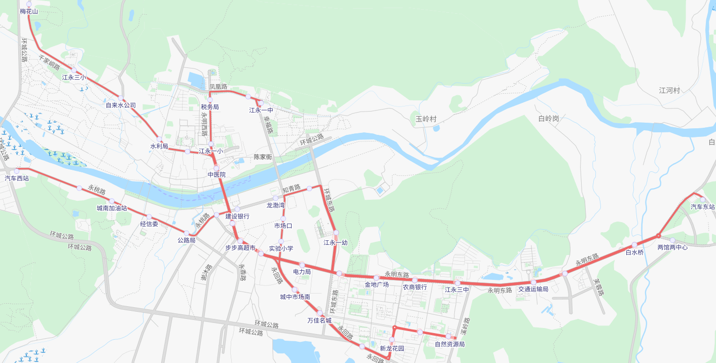
江永县OSM交通运输地图
Map generated from OSM data and Transport data by Thunderforest.
| Contains map data © OpenStreetMap contributors, made available under the terms of the Open Database License (ODbL).
The ODbL does not require any particular license for maps produced from ODbL data, produced maps may be subject also to other licences. |
File history
Click on a date/time to view the file as it appeared at that time.
| Date/Time | Thumbnail | Dimensions | User | Comment | |
|---|---|---|---|---|---|
| current | 09:28, 11 September 2022 | | 1,412 × 716 (441 KB) | Lancelotance (talk | contribs) |
You cannot overwrite this file.
File usage
The following page uses this file: