File:OSMdata bandeau 2020-11.JPG
Jump to navigation
Jump to search

Size of this preview: 800 × 412 pixels. Other resolutions: 320 × 165 pixels | 640 × 330 pixels | 1,024 × 528 pixels | 1,680 × 866 pixels.
Original file (1,680 × 866 pixels, file size: 147 KB, MIME type: image/jpeg)
Summary
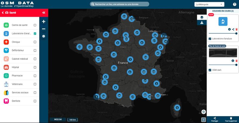
Capture écran d'OSMdata dans sa version de fin 2020. Dans cet exemple un affichage est fait des laboratoires d'analyses en France.
Licensing
![]()
![]()
This work is licensed under the Creative Commons Attribution 4.0 License.
File history
Click on a date/time to view the file as it appeared at that time.
| Date/Time | Thumbnail | Dimensions | User | Comment | |
|---|---|---|---|---|---|
| current | 12:13, 6 February 2021 | | 1,680 × 866 (147 KB) | J-Louis ZIMMERMANN (talk | contribs) | Capture écran d'OSMdata dans sa version de fin 2020. Dans cet exemple un affichage est fait des laboratoires d'analyses en France. |
You cannot overwrite this file.
File usage
The following page uses this file: