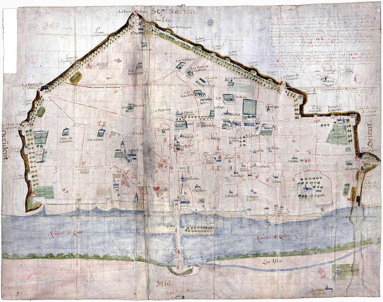
File:Orléans-Plan de la ville par Jean Fleury - 1640.jpg
Jump to navigation
Jump to search

Size of this preview: 758 × 599 pixels. Other resolutions: 304 × 240 pixels | 607 × 480 pixels | 972 × 768 pixels | 1,280 × 1,012 pixels | 1,366 × 1,080 pixels.
Original file (1,366 × 1,080 pixels, file size: 515 KB, MIME type: image/jpeg)
Summary
| Description | Plan de la ville d'Orléans - 1640 |
|---|---|
| Author | BMO Rés. ZH 34 |
| Source | https://multimedia.inrap.fr/atlas/orleans/sites/2485/Parking-Gambetta |
Licensing
![]()
![]()
![]()
This work is licensed under the Creative Commons Attribution-ShareAlike 4.0 License.
Attribution: BMO Rés. ZH 34
Attribution: BMO Rés. ZH 34
File history
Click on a date/time to view the file as it appeared at that time.
| Date/Time | Thumbnail | Dimensions | User | Comment | |
|---|---|---|---|---|---|
| current | 10:52, 11 June 2023 | | 1,366 × 1,080 (515 KB) | Eric Bie (talk | contribs) | {{Information | description=Plan de la ville d'Orléans - 1640 | source=https://multimedia.inrap.fr/atlas/orleans/sites/2485/Parking-Gambetta | date= | author=BMO Rés. ZH 34 | other_versions= }} |
You cannot overwrite this file.
File usage
The following page uses this file: