File:Osm Go-main interface and aerial image.png
Osm_Go-main_interface_and_aerial_image.png (251 × 446 pixels, file size: 168 KB, MIME type: image/png)
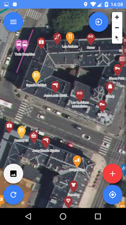
Summary
Main interface of Osm Go! and aerial imagery from Mapbox satellite
License
- Note:the satellite imagery is form "Mapbox satellite" - see terms and conditions in https://www.mapbox.com/tos/ Is used here only for illustrative purposes, like Bing images, to inform and help mappers. Please don't use this image if the satellite imagery is shown in other context.
The following licenses apply only to Osm Go! app interface and POIs:
![]()
Copyright © The author(s)
Permission is hereby granted, free of charge, to any person obtaining a copy of this software and associated documentation files (the "Software"), to deal in the Software without restriction, including without limitation the rights to use, copy, modify, merge, publish, distribute, sublicense, and/or sell copies of the Software, and to permit persons to whom the Software is furnished to do so, subject to the following conditions:
The above copyright notice and this permission notice shall be included in all copies or substantial portions of the Software.
The Software is provided "as is", without warranty of any kind, express or implied, including but not limited to the warranties of merchantability, fitness for a particular purpose and noninfringement. In no event shall the authors or copyright holders be liable for any claim, damages or other liability, whether in an action of contract, tort or otherwise, arising from, out of or in connection with the Software or the use or other dealings in the Software.| Contains map data © OpenStreetMap contributors, made available under the terms of the Open Database License (ODbL).
The ODbL does not require any particular license for maps produced from ODbL data, produced maps may be subject also to other licences. |
File history
Click on a date/time to view the file as it appeared at that time.
| Date/Time | Thumbnail | Dimensions | User | Comment | |
|---|---|---|---|---|---|
| current | 10:58, 25 September 2018 | | 251 × 446 (168 KB) | Zermes (talk | contribs) | == Summary == Main interface of Osm Go! and aerial imagery from Mapbox satellite == License == :Note:the satellite imagery is form "Mapbox satellite" - see terms and conditions in https://www.mapbox.com/tos/ Is used here only for illustrative purposes... |
You cannot overwrite this file.
File usage
The following 4 pages use this file: