File:POI Auswertung LA Karte.png
Jump to navigation
Jump to search

Size of this preview: 800 × 477 pixels. Other resolutions: 320 × 191 pixels | 640 × 382 pixels | 993 × 592 pixels.
Original file (993 × 592 pixels, file size: 244 KB, MIME type: image/png)
Summary
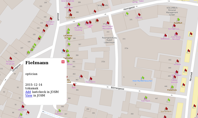
Interaktive Karte basierend auf OpenLayers mit Anzeige der ausgewählter POIs in Landshut. Farbliche Markierung anhand des 'lastcheck' Tags und Links zur Weiterverarbeitung in JOSM.
Licensing
| Contains map data © OpenStreetMap contributors, made available under the terms of the Open Database License (ODbL).
The ODbL does not require any particular license for maps produced from ODbL data, produced maps may be subject also to other licences. |
File history
Click on a date/time to view the file as it appeared at that time.
| Date/Time | Thumbnail | Dimensions | User | Comment | |
|---|---|---|---|---|---|
| current | 09:43, 17 December 2015 | | 993 × 592 (244 KB) | Blutsauger (talk | contribs) | Interaktive Karte basierend auf OpenLayers mit Anzeige der ausgewählter POIs in Landshut. Farbliche Markierung anhand des 'lastcheck' Tags und Links zur Weiterverarbeitung in JOSM. |
You cannot overwrite this file.
File usage
The following page uses this file: