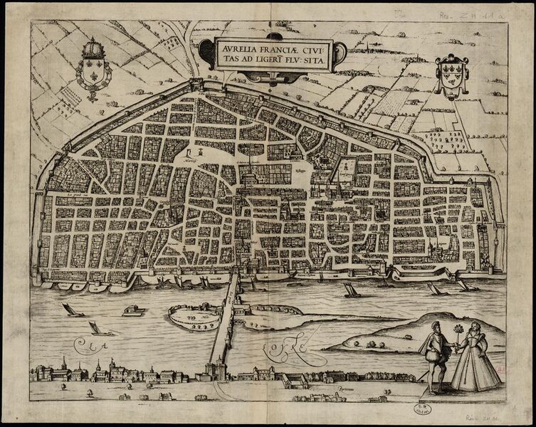
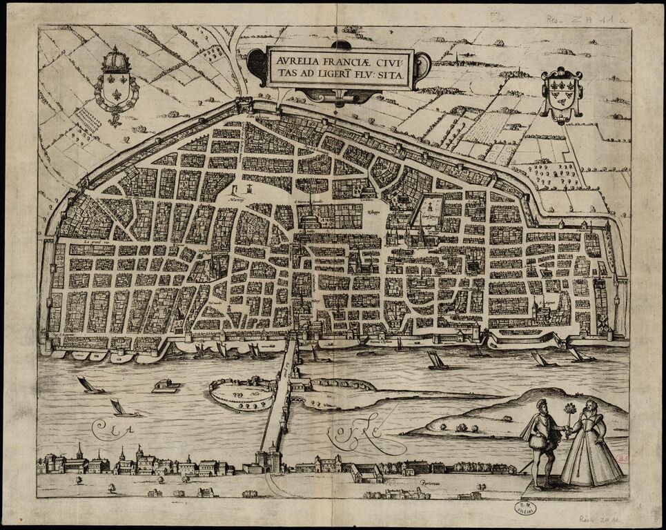
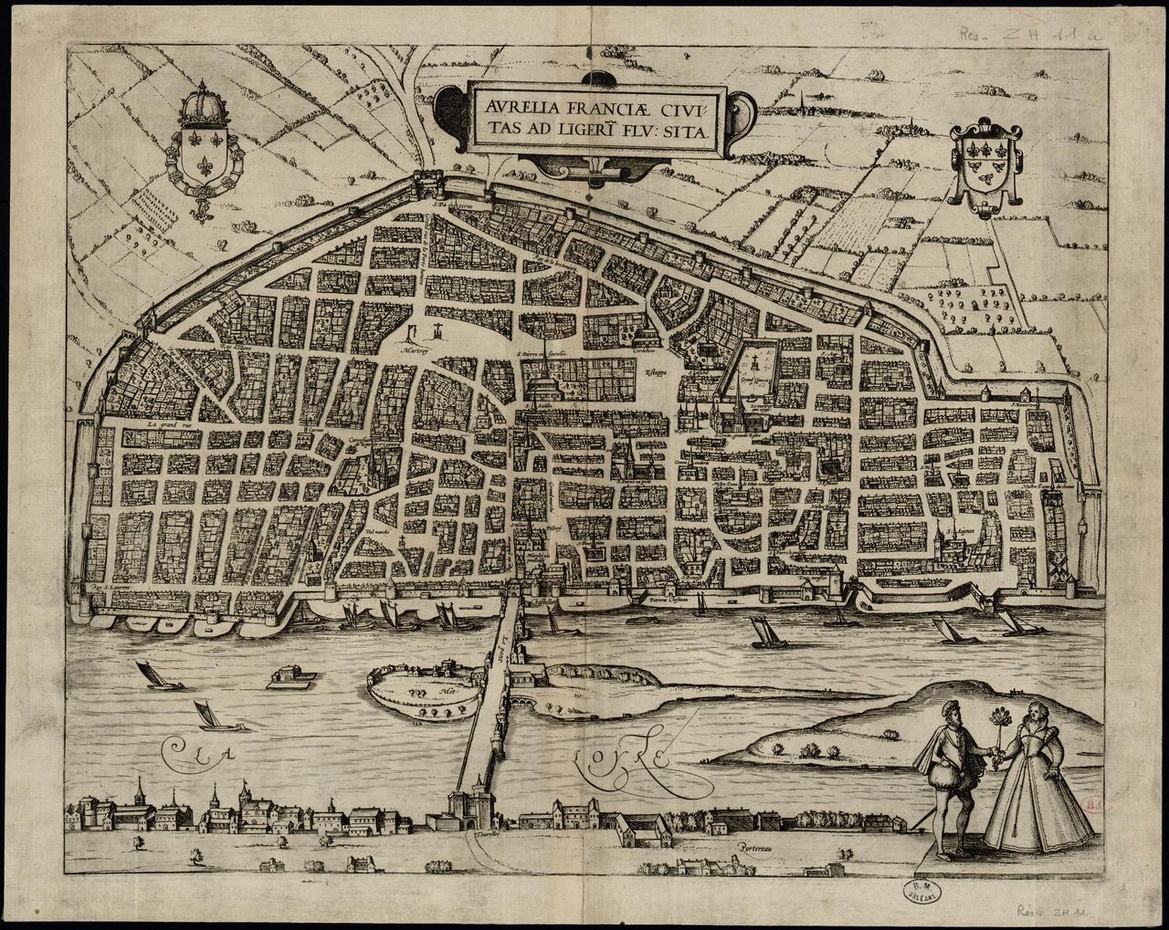
File:Plan d'Orléans (1599) Aurelia Franciae civitas ad Ligeri flumen sita.jpg
Jump to navigation
Jump to search

Size of this preview: 753 × 600 pixels. Other resolutions: 302 × 240 pixels | 603 × 480 pixels | 965 × 768 pixels | 1,280 × 1,019 pixels | 2,396 × 1,908 pixels.
Original file (2,396 × 1,908 pixels, file size: 1.11 MB, MIME type: image/jpeg)
Summary
| Description | Plan d'Orléans (1599) |
|---|---|
| Author | Braun, Georg (1541-1622);Hogenberg, Franz (1535-1590) |
| Source | https://mediatheques.orleans-metropole.fr/ark:/77916/ORL41650/v0001.simple.selectedTab=record |
| Date | 1599 |
Licensing
![]()
This file is in a public domain because the copyrightable material in it is so old that the copyright to it is expired.
File history
Click on a date/time to view the file as it appeared at that time.
| Date/Time | Thumbnail | Dimensions | User | Comment | |
|---|---|---|---|---|---|
| current | 09:25, 21 May 2023 | | 2,396 × 1,908 (1.11 MB) | Eric Bie (talk | contribs) | {{Information | description=Plan d'Orléans (1599) | source=https://mediatheques.orleans-metropole.fr/ark:/77916/ORL41650/v0001.simple.selectedTab=record | date=1599 | author=Braun, Georg (1541-1622);Hogenberg, Franz (1535-1590) | other_versions= }} |
You cannot overwrite this file.
File usage
The following page uses this file:
_Aurelia_Franciae_civitas_ad_Ligeri_flumen_sita.jpg&oldid=2598946)