File:Railway=Station Tagging Node.svg
Jump to navigation
Jump to search

Size of this PNG preview of this SVG file: 512 × 224 pixels. Other resolutions: 320 × 140 pixels | 640 × 280 pixels | 1,024 × 448 pixels | 1,280 × 560 pixels.
Original file (SVG file, nominally 512 × 224 pixels, file size: 7 KB)
Summary
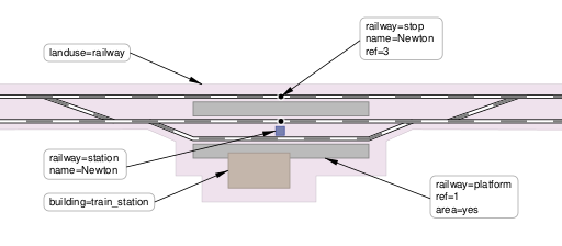
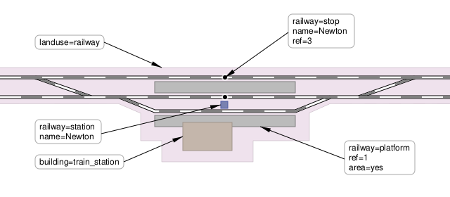
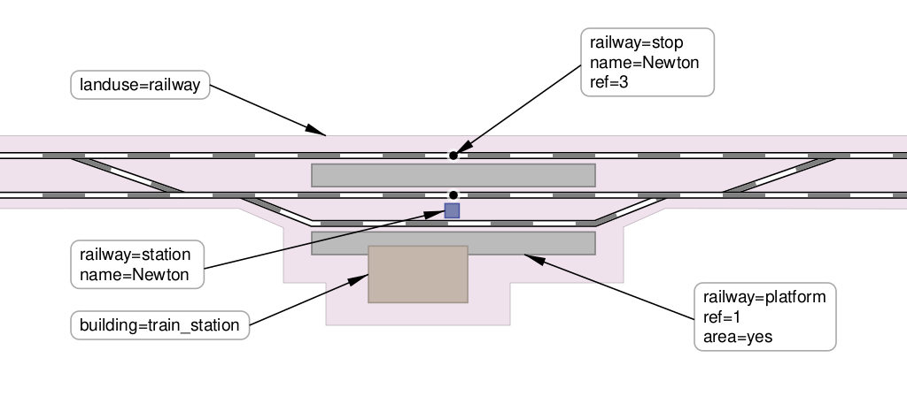
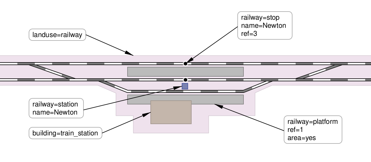
| Description | Tagging diagram for tags relevant to 'railway=station' objects. Remove all information relating to other schemas. Remove all gumpf added by numerous svg editors. Made objects similar to OSM-Carto rendering. |
|---|---|
| Author | DaveF |
| Source | Other svg diagrams. |
| Date | 12/04/24 |
Licensing
![]()
This image or logo only consists of typefaces, individual words, slogans, or simple geometric shapes. These are not eligible for copyright alone because they are not original enough, and thus the image is considered to be in the public domain.
See Public domain or Restricted materials on Wikipedia for more information.
Please note: The public domain status of this work is only in regards to its copyright status. There may be other intellectual property restrictions protecting this image, such as trademarks or design patents if it is a logo.
See
Please note: The public domain status of this work is only in regards to its copyright status. There may be other intellectual property restrictions protecting this image, such as trademarks or design patents if it is a logo.
File history
Click on a date/time to view the file as it appeared at that time.
| Date/Time | Thumbnail | Dimensions | User | Comment | |
|---|---|---|---|---|---|
| current | 09:52, 15 April 2024 | | 512 × 224 (7 KB) | Dieterdreist (talk | contribs) | landuse=railway extending on all railway landuse |
| 20:04, 12 April 2024 |  | 512 × 224 (4 KB) | DaveF63 (talk | contribs) | Rescaling | |
| 16:18, 12 April 2024 |  | 1,063 × 531 (4 KB) | DaveF63 (talk | contribs) | {{Information | description= Tagging diagram for tags relevant to 'railway=station' objects. Remove all information relating to other schemas. Remove all gumpf added by numerous svg editors. Made objects similar to OSM-Carto rendering. | source= Other svg diagrams. | date= 12/04/24 | author=DaveF | other_versions= }} |
You cannot overwrite this file.
File usage
There are no pages that use this file.