File:Rat rd uprn pc.png
Jump to navigation
Jump to search

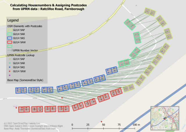
Size of this preview: 800 × 566 pixels. Other resolutions: 320 × 226 pixels | 640 × 453 pixels | 1,024 × 724 pixels | 1,280 × 905 pixels | 2,560 × 1,810 pixels | 3,507 × 2,480 pixels.
Original file (3,507 × 2,480 pixels, file size: 1.62 MB, MIME type: image/png)
Summary
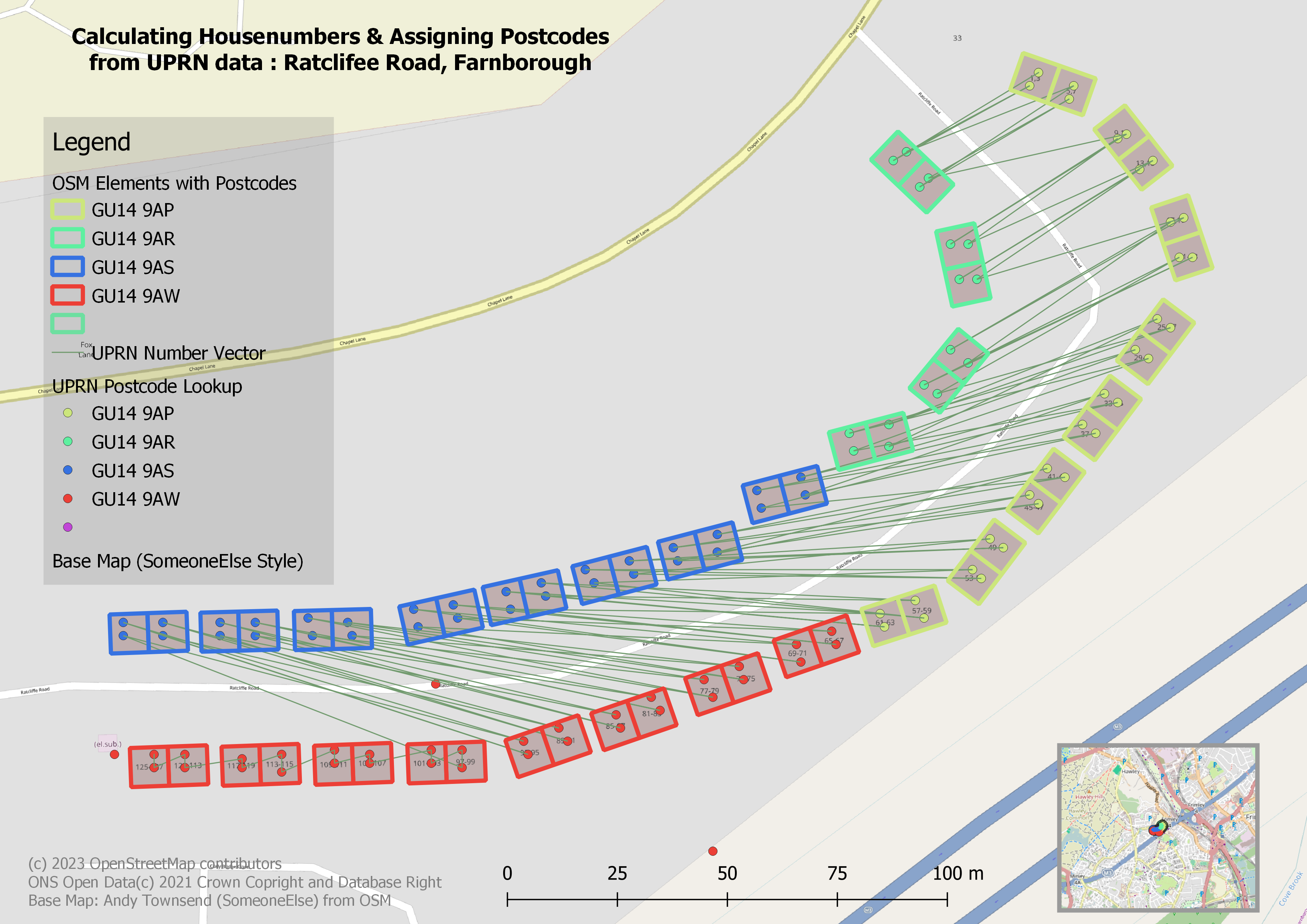
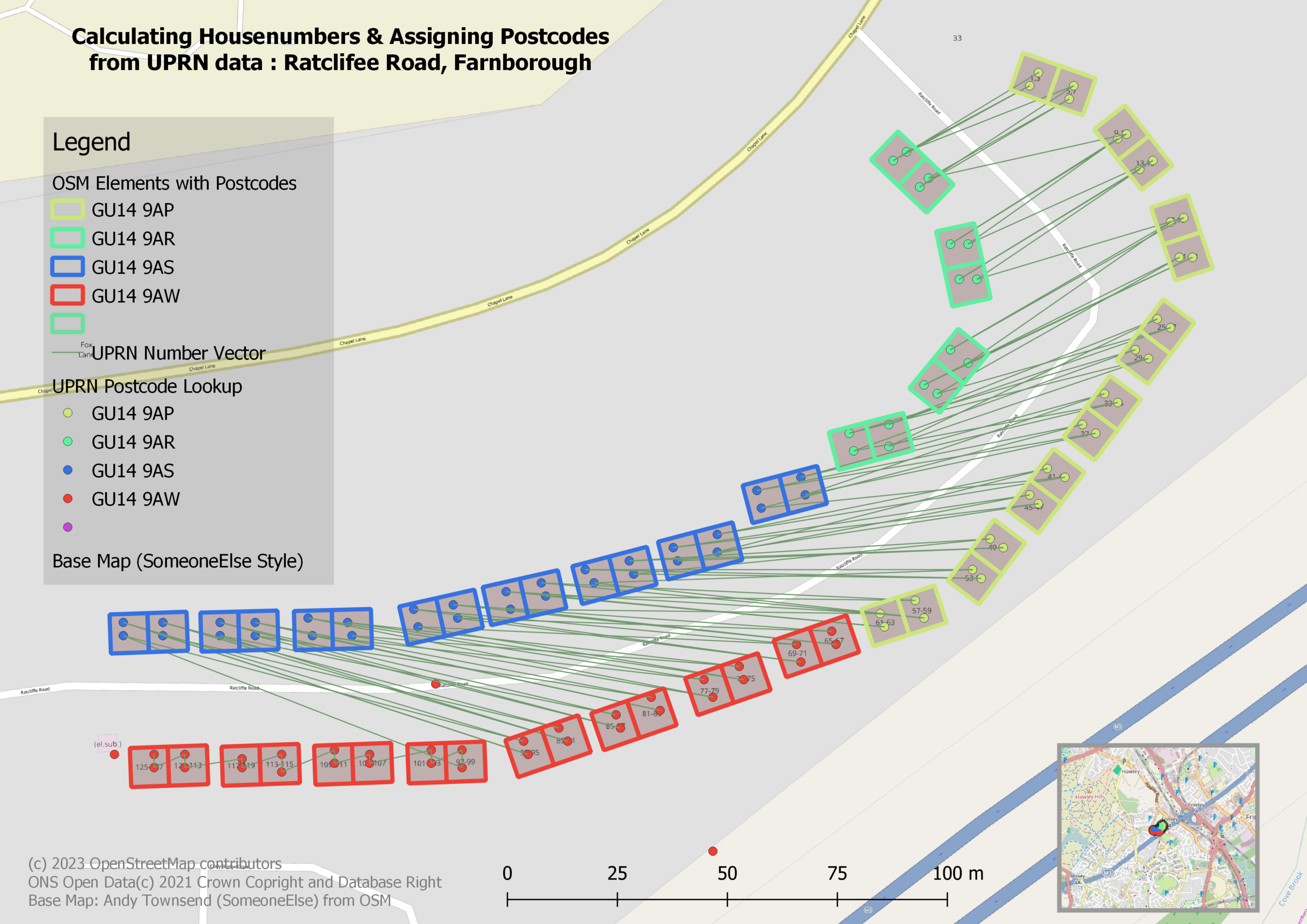
| Description | Ratcliffe Road, Farnborough checking postcodes assigned from UPRNs are correct (dots PCs from UPRN/house outlines from OSM). Zigzag line is UPRN number vector (proxyy for housenumbers) |
|---|---|
| Author | SK53 |
| Source | ONS UPRN Lookup Open Data ((C) 2021 Crown Copyright and Database Right), OpenStreetMap. Background map OSM data rendered by SomeoneElse |
| Date | 2023-07-13 |
Licensing
| Contains map data © OpenStreetMap contributors, made available under the terms of the Open Database License (ODbL).
The ODbL does not require any particular license for maps produced from ODbL data, produced maps may be subject also to other licences. |
File history
Click on a date/time to view the file as it appeared at that time.
| Date/Time | Thumbnail | Dimensions | User | Comment | |
|---|---|---|---|---|---|
| current | 17:31, 13 July 2023 | | 3,507 × 2,480 (1.62 MB) | SK53 (talk | contribs) | add legend, location map, attribution & title |
| 10:03, 13 July 2023 | 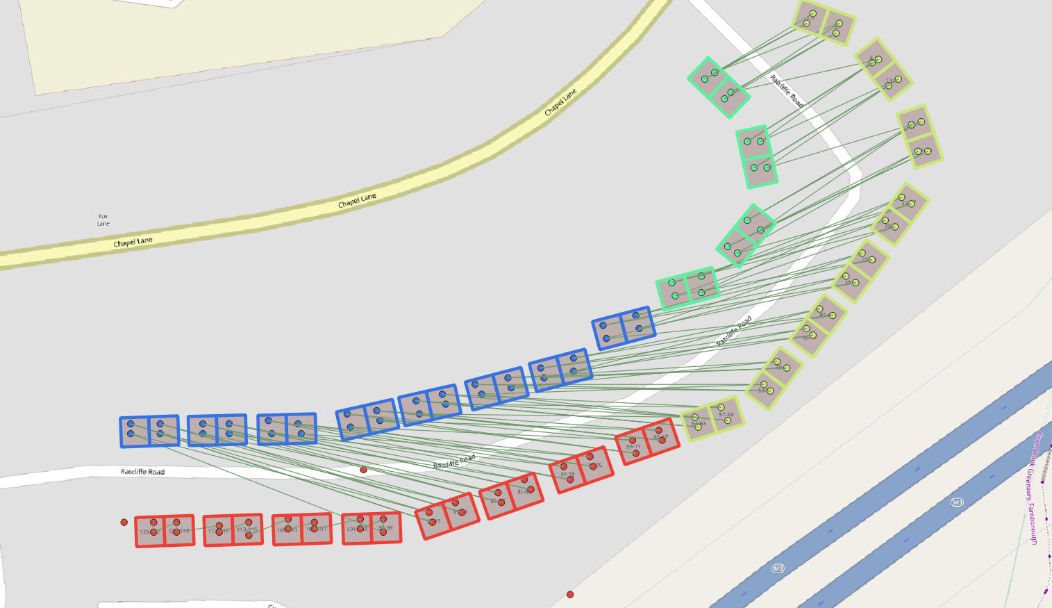 | 1,515 × 875 (390 KB) | SK53 (talk | contribs) | {{Information | description=Ratcliffe Road, Farnborough checking postcodes assigned from UPRNs are correct (dots PCs from UPRN/house outlines from OSM). Zigzag line is UPRN number vector (proxyy for housenumbers) | source=ONS UPRN Lookup Open Data ((C) 2021 Crown Copyright and Database Right), OpenStreetMap. Background map OSM data rendered by SomeoneElse | date=2023-07-13 | author=SK53 | other_versions= }} |
You cannot overwrite this file.
File usage
There are no pages that use this file.