File:Ru Tagschemaparking vialibera.jpg
Jump to navigation
Jump to search


Size of this preview: 800 × 600 pixels. Other resolutions: 320 × 240 pixels | 640 × 480 pixels | 1,024 × 768 pixels | 1,280 × 960 pixels | 1,668 × 1,251 pixels.
Original file (1,668 × 1,251 pixels, file size: 631 KB, MIME type: image/jpeg)
Summary
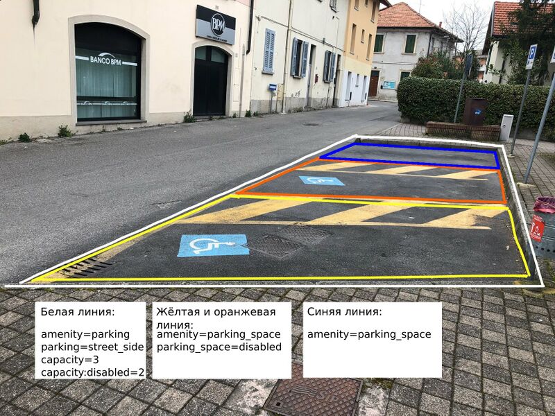
Russian version of File:Tagschemaparking_vialibera.jpg (белая линия, жёлтая и оранжевая линия)
Summary
| Description | Схема разметки парковки в проекте ViaLibera. |
|---|---|
| Author | |
| Source |
|
| Other versions |
|


Licensing
![]()
![]()
This work is licensed under the Creative Commons Attribution 4.0 License.
File history
Click on a date/time to view the file as it appeared at that time.
| Date/Time | Thumbnail | Dimensions | User | Comment | |
|---|---|---|---|---|---|
| current | 07:07, 6 September 2022 | | 1,668 × 1,251 (631 KB) | Grass-snake (talk | contribs) | capacity=1 is redundant as it is implied by the lack of capacity tag |
| 14:43, 21 June 2022 |  | 1,673 × 1,255 (704 KB) | Grass-snake (talk | contribs) | capacity=1 && parking_space=normal | |
| 20:02, 31 December 2021 | 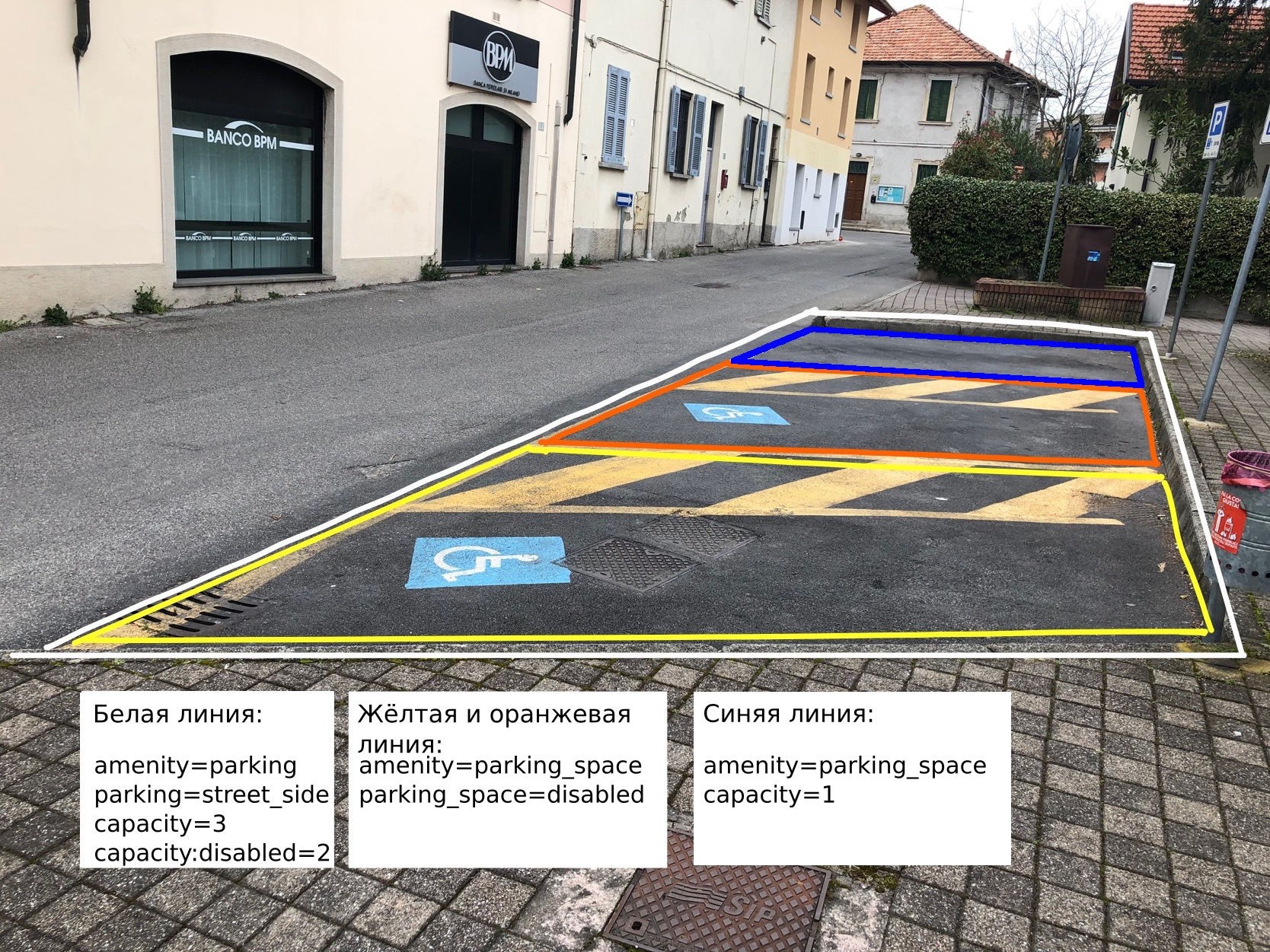 | 1,668 × 1,251 (1.27 MB) | Grass-snake (talk | contribs) | Updated white parking tagging schema | |
| 10:15, 23 June 2021 | 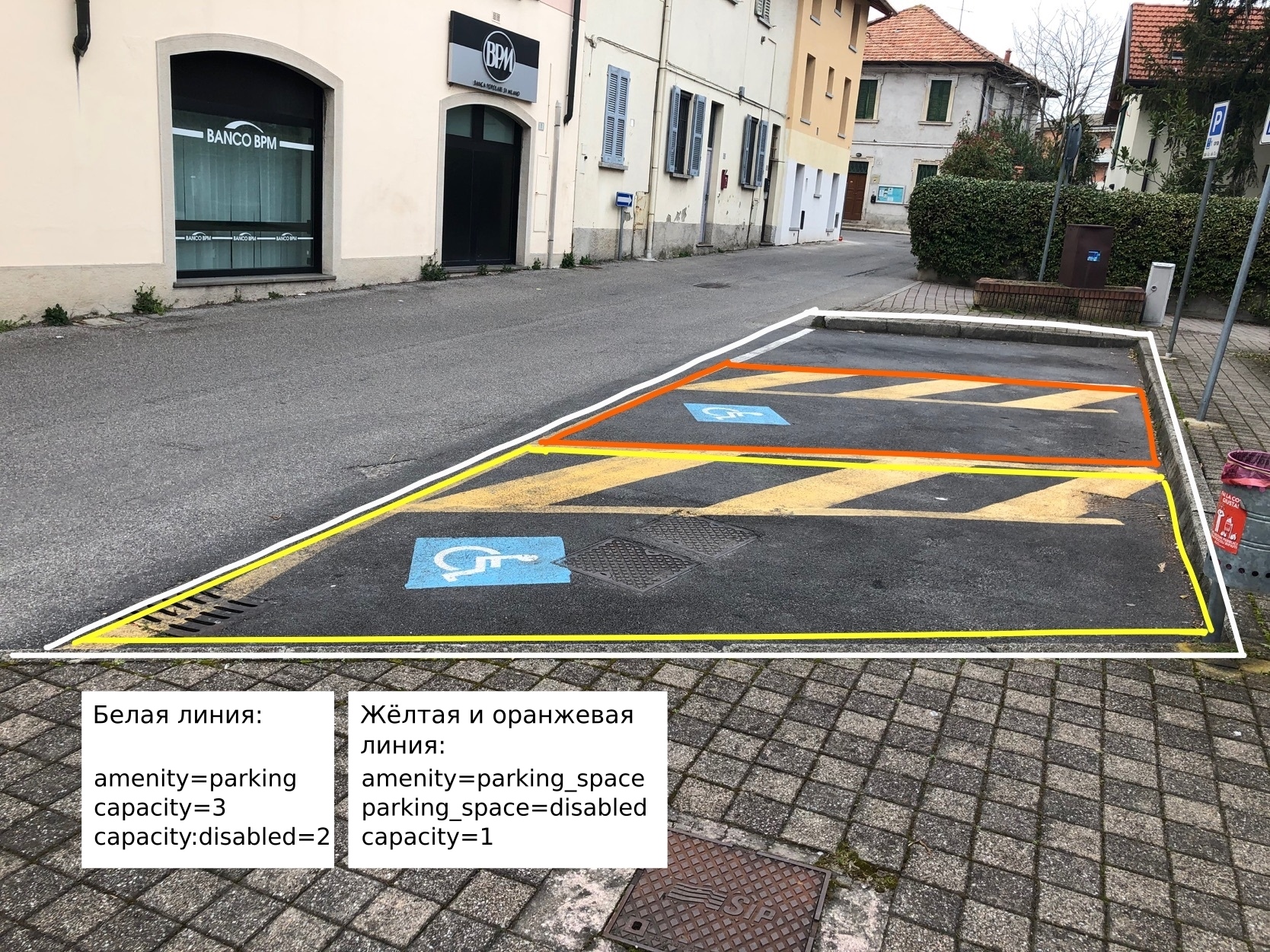 | 1,668 × 1,251 (1.33 MB) | Grass-snake (talk | contribs) | Russian version of File:Tagschemaparking_vialibera.jpg (белая линия, жёлтая и оранжевая линия) |
You cannot overwrite this file.
File usage
The following 2 pages use this file: