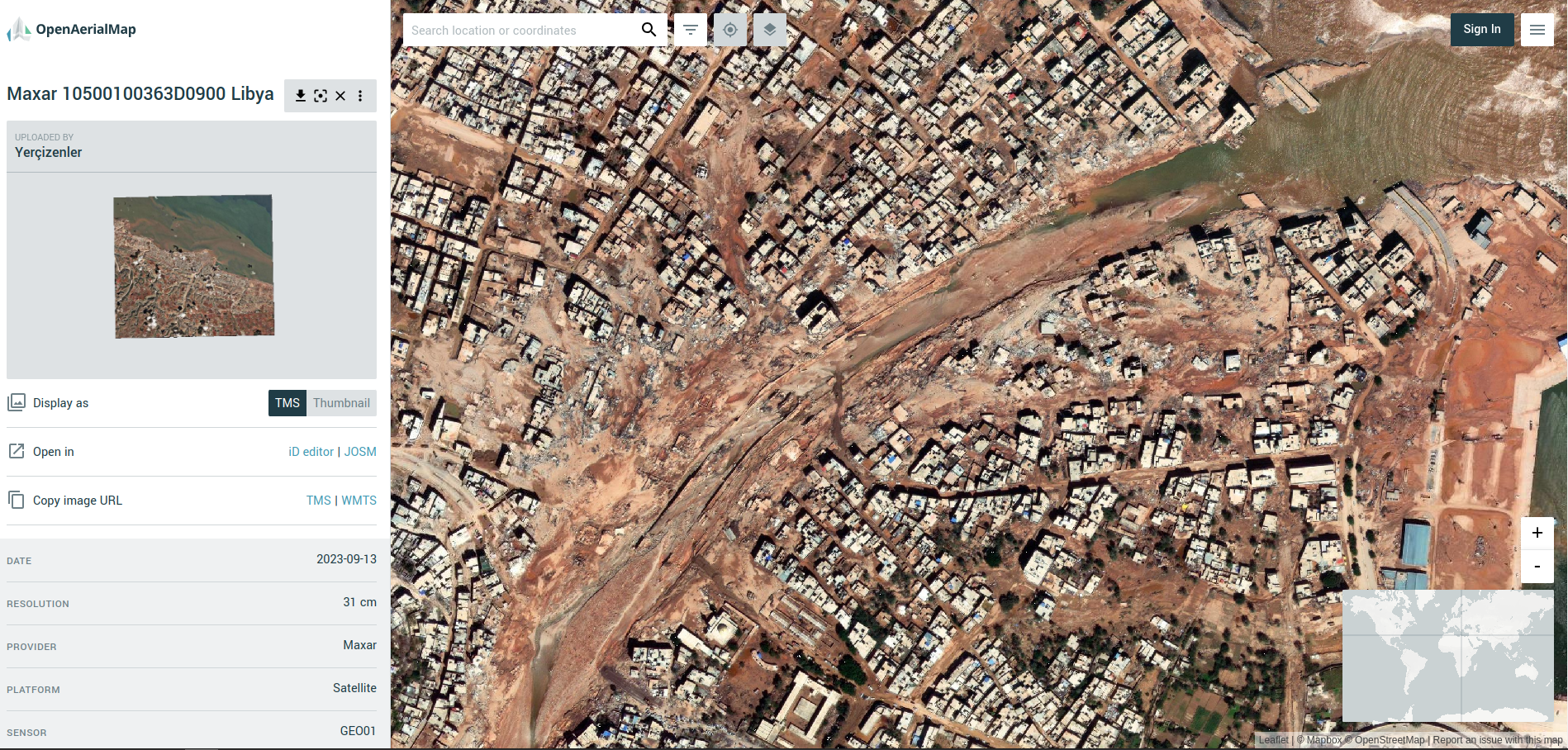
File:Screenshot from OpenAerialMap Libya Floods.png
Jump to navigation
Jump to search

Size of this preview: 800 × 383 pixels. Other resolutions: 320 × 153 pixels | 640 × 306 pixels | 1,024 × 490 pixels | 1,898 × 908 pixels.
Original file (1,898 × 908 pixels, file size: 3 MB, MIME type: image/png)
Summary
| Description | Screenshot from OpenAerialMap (Libya Floods) |
|---|---|
| Author | |
| Source | https://map.openaerialmap.org/#/22.645745873451233,32.764461054579826,17/square/122102220202011/65029d220906de000167e685?_k=8xj1mx |
| Date | 18 Sept 2023 |
Licensing
![]()
![]()
This work is licensed under the Creative Commons Attribution 4.0 License.
File history
Click on a date/time to view the file as it appeared at that time.
| Date/Time | Thumbnail | Dimensions | User | Comment | |
|---|---|---|---|---|---|
| current | 07:17, 18 September 2023 | | 1,898 × 908 (3 MB) | Pedrito1414 (talk | contribs) | {{Information | description=Screenshot from OpenAerialMap (Libya Floods) | source=https://map.openaerialmap.org/#/22.645745873451233,32.764461054579826,17/square/122102220202011/65029d220906de000167e685?_k=8xj1mx | date=18 Sept 2023 | author= | other_versions= }} |
You cannot overwrite this file.
File usage
There are no pages that use this file.