File:Turkestan-map.jpg
Jump to navigation
Jump to search


Size of this preview: 757 × 600 pixels. Other resolutions: 303 × 240 pixels | 606 × 480 pixels | 970 × 768 pixels | 1,280 × 1,014 pixels | 1,780 × 1,410 pixels.
Original file (1,780 × 1,410 pixels, file size: 749 KB, MIME type: image/jpeg)
Summary
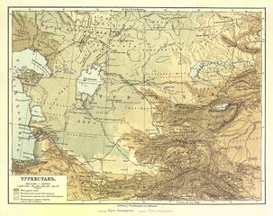
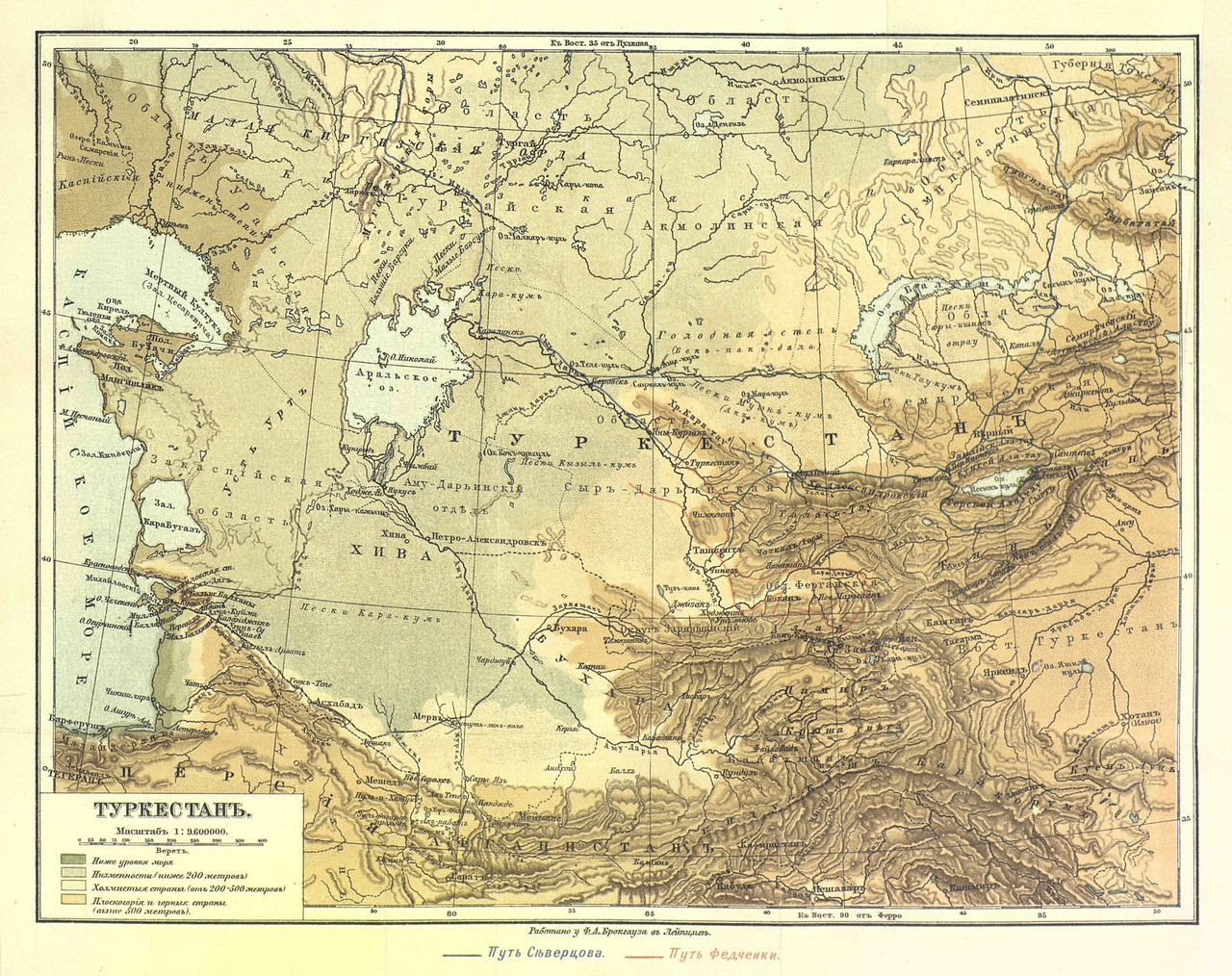
| Description | A 19th-century map of "Turkestan" after its conquest by the Russian Empire. |
|---|---|
| Author | ??? |
| Source | ??? |
| Date | 19th-century |
Licensing
Copyright has expired.
![]()
This file has been released into the public domain by the copyright holder, its copyright has expired, or it is ineligible for copyright. This applies worldwide.
Please, please use more specific template such as {{PD-self}} / {{PD-creator}} / {{PD-shape}} / {{PD-USGov}} / {{PD-old}} / {{PD-RU-exempt}} ... This template is not making clear why this work is in the public domain.
Please, please use more specific template such as {{PD-self}} / {{PD-creator}} / {{PD-shape}} / {{PD-USGov}} / {{PD-old}} / {{PD-RU-exempt}} ... This template is not making clear why this work is in the public domain.
File history
Click on a date/time to view the file as it appeared at that time.
| Date/Time | Thumbnail | Dimensions | User | Comment | |
|---|---|---|---|---|---|
| current | 16:13, 9 July 2018 | | 1,780 × 1,410 (749 KB) | Apm-wa (talk | contribs) | A 19th-century map of "Turkestan". Copyright has expired. |
You cannot overwrite this file.
File usage
The following page uses this file: