File:Vastergotland-outline.png
Jump to navigation
Jump to search


Size of this preview: 786 × 600 pixels. Other resolutions: 315 × 240 pixels | 629 × 480 pixels | 923 × 704 pixels.
Original file (923 × 704 pixels, file size: 28 KB, MIME type: image/png)
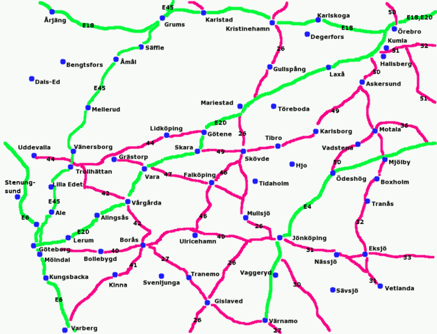
Very primitive handmade map of the province Västergötland in Sweden with the principal cities and roads. European routes are drawn in green, Swedish riksvägar in red.
File history
Click on a date/time to view the file as it appeared at that time.
| Date/Time | Thumbnail | Dimensions | User | Comment | |
|---|---|---|---|---|---|
| current | 12:29, 29 March 2007 | | 923 × 704 (28 KB) | Leojth (talk | contribs) | |
| 12:52, 20 February 2006 | 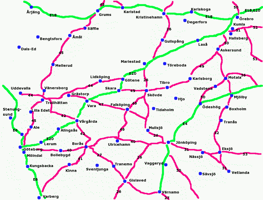 | 923 × 704 (28 KB) | LA2 (talk | contribs) | New version | |
| 06:57, 20 February 2006 | 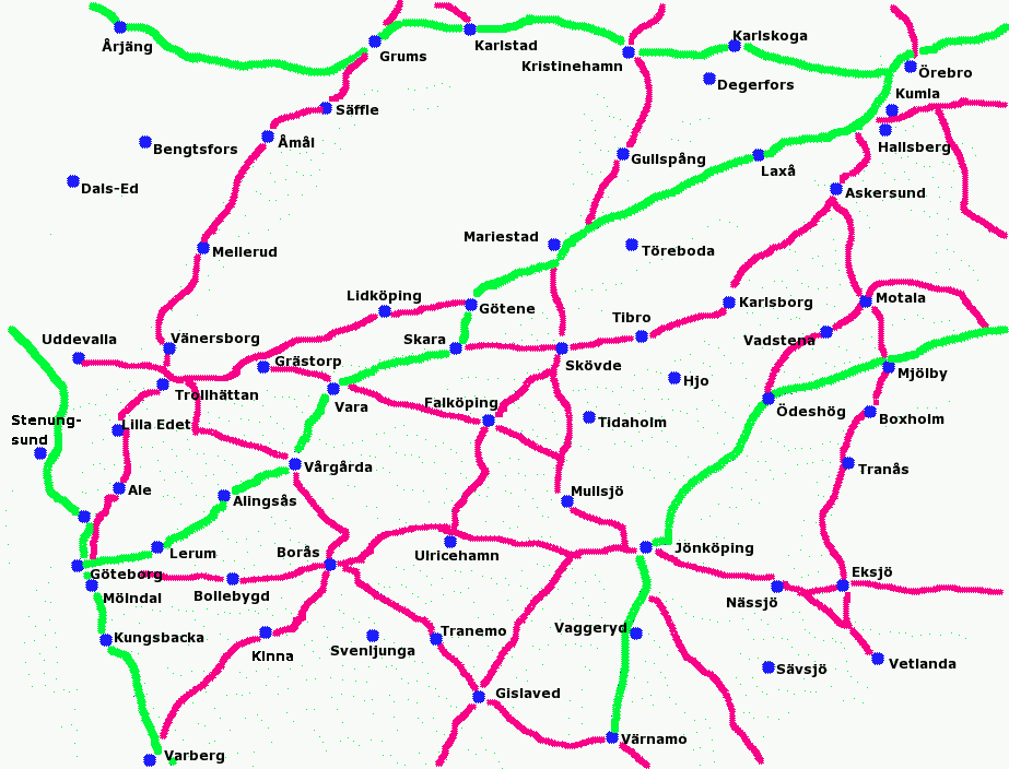 | 923 × 704 (27 KB) | LA2 (talk | contribs) | New version | |
| 06:26, 20 February 2006 |  | 923 × 704 (27 KB) | LA2 (talk | contribs) | Very primitive handmade map of the province Västergötland with the principal cities and roads. European routes are drawn in green, Swedish riksvägar in red. |
You cannot overwrite this file.
File usage
The following page uses this file: