File:Vermont Town Boundary Import 2018-Poultney-Hampton.png
Jump to navigation
Jump to search


Size of this preview: 480 × 600 pixels. Other resolutions: 192 × 240 pixels | 384 × 480 pixels | 896 × 1,120 pixels.
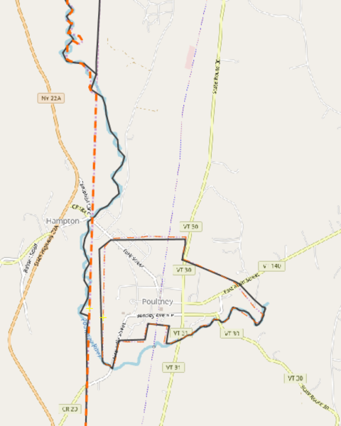
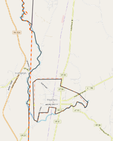
Original file (896 × 1,120 pixels, file size: 154 KB, MIME type: image/png)
Screen shot of differences between the Vermont data and OSM.
Licensing
![]()
Contains map data © OpenStreetMap contributors, made available under the terms of the Creative Commons Attribution-ShareAlike 2.0 (CC-BY-SA-2.0).
File history
Click on a date/time to view the file as it appeared at that time.
| Date/Time | Thumbnail | Dimensions | User | Comment | |
|---|---|---|---|---|---|
| current | 15:58, 5 February 2018 | | 896 × 1,120 (154 KB) | Adamfranco (talk | contribs) |
You cannot overwrite this file.
File usage
The following page uses this file: