File:View SE Mynydd Rhiw.jpg
Jump to navigation
Jump to search

Size of this preview: 800 × 600 pixels. Other resolutions: 320 × 240 pixels | 640 × 480 pixels | 1,024 × 768 pixels.
Original file (1,024 × 768 pixels, file size: 375 KB, MIME type: image/jpeg)
Summary
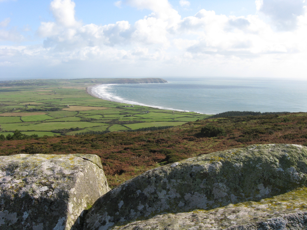
Porth Neigwl from Mynydd Rhiw. Heathland vegetation in foreground. The forestry in on the skyline to the right has been felled since 2008. This makes contrast between the heath and farmland very obvious.
Licensing
![]()
![]()
![]()
This work is licensed under the Creative Commons Attribution-ShareAlike 4.0 License.
Attribution not specified as a parameter! THIS LICENSE ALWAYS REQUIRES ATTRIBUTION! Use {{CC-BY-SA-4.0|Attribution, typically name of author}} See Template:CC-BY-SA-4.0 for full description this template should be used.
Attribution not specified as a parameter! THIS LICENSE ALWAYS REQUIRES ATTRIBUTION! Use {{CC-BY-SA-4.0|Attribution, typically name of author}} See Template:CC-BY-SA-4.0 for full description this template should be used.
File history
Click on a date/time to view the file as it appeared at that time.
| Date/Time | Thumbnail | Dimensions | User | Comment | |
|---|---|---|---|---|---|
| current | 10:41, 16 November 2021 | | 1,024 × 768 (375 KB) | SK53 (talk | contribs) | Porth Neigwl from Mynydd Rhiw. Heathland vegetation in foreground. The forestry in on the skyline to the right has been felled since 2008. This makes contrast between the heath and farmland very obvious. |
You cannot overwrite this file.
File usage
There are no pages that use this file.