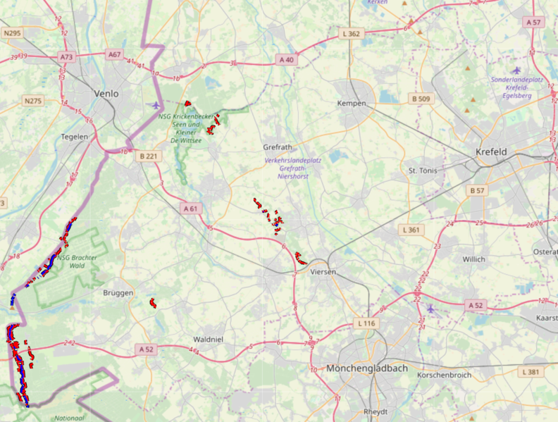
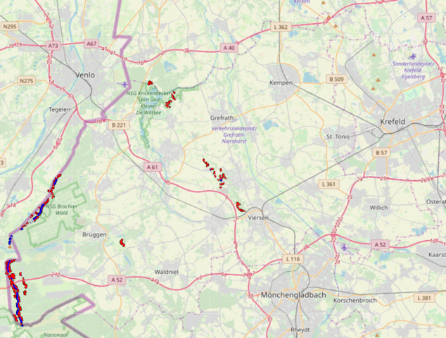
File:WW2 overview.png
Jump to navigation
Jump to search


Size of this preview: 792 × 599 pixels. Other resolutions: 317 × 240 pixels | 634 × 480 pixels | 1,015 × 768 pixels | 1,024 × 775 pixels.
Original file (1,024 × 775 pixels, file size: 1.4 MB, MIME type: image/png)
WW2 Verteidigungslinien im Kreis Viersen
File history
Click on a date/time to view the file as it appeared at that time.
| Date/Time | Thumbnail | Dimensions | User | Comment | |
|---|---|---|---|---|---|
| current | 22:43, 4 February 2019 | | 1,024 × 775 (1.4 MB) | Waldhans (talk | contribs) |
You cannot overwrite this file.
File usage
The following 2 pages use this file: