File:Wallasey uprn vectors by pc.png

Original file (1,143 × 875 pixels, file size: 1.42 MB, MIME type: image/png)
Summary
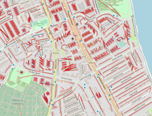
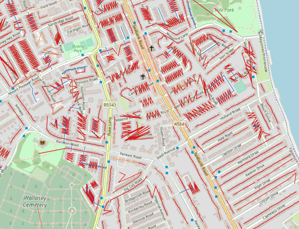
Vectors of UPRNs in runs of more than 2 allocated by Postcode. If there is a gap of more than 5 uprns another sequence is created in that postcode. The vectors instantly inform how postcodes are allocated on a street & the direction of housenumbers (assuming uprn increase with housenumber)
Contains UPRN and UPRN to Postcode data (ONS) (c) Crown copyright 2021 released under the Open Government Licence.
Licensing
| Contains map data © OpenStreetMap contributors, made available under the terms of the Open Database License (ODbL).
The ODbL does not require any particular license for maps produced from ODbL data, produced maps may be subject also to other licences. |
File history
Click on a date/time to view the file as it appeared at that time.
| Date/Time | Thumbnail | Dimensions | User | Comment | |
|---|---|---|---|---|---|
| current | 19:23, 13 July 2021 | | 1,143 × 875 (1.42 MB) | SK53 (talk | contribs) | Vectors of UPRNs in runs of more than 2 allocated by Postcode. If there is a gap of more than 5 uprns another sequence is created in that postcode. The vectors instantly inform how postcodes are allocated on a street & the direction of housenumbers (assuming uprn increase with housenumber) Contains UPRN and UPRN to Postcode data (ONS) (c) Crown copyright 2021 released under the Open Government Licence. |
You cannot overwrite this file.
File usage
There are no pages that use this file.