File:Welsh medium schools.jpg

Original file (2,952 × 2,952 pixels, file size: 1.03 MB, MIME type: image/jpeg)
Summary
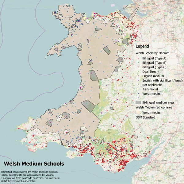
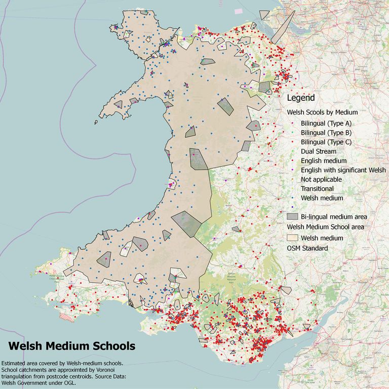
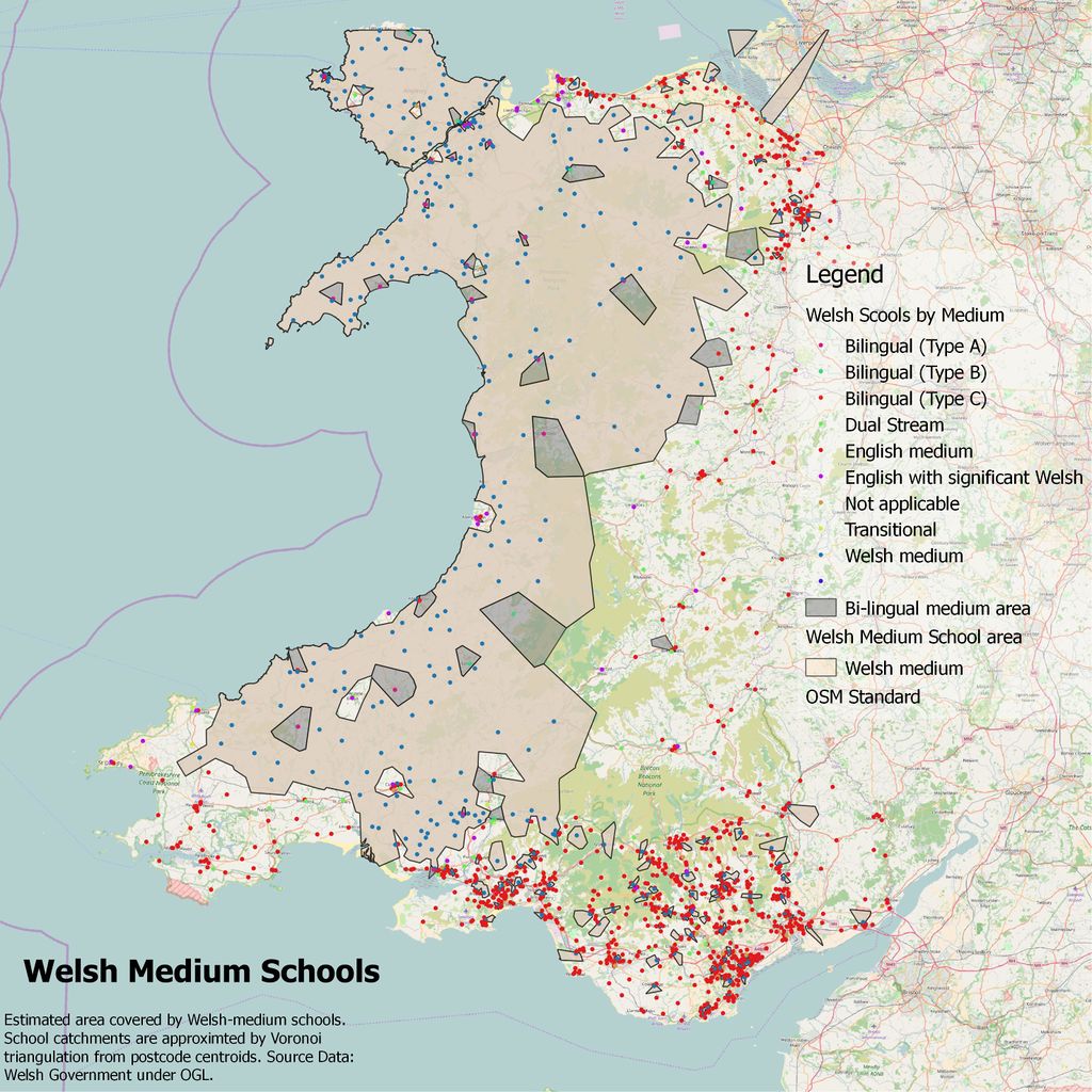
Open Data for the medium of instruction in schools in Wales was used to identify candidate areas where use of Welsh in place names etc., is likely to be of significance.
Schools were classified as "Welsh Medium", "Bilingual" or "other. Voronoi triangles were created, clipped to the coastline and merged to create an area where Welsh is likely to be in significant use.
For use with SomeoneElse's "Useful Maps" rendering the area was generalised by buffering by 5 km and converted into a .poly file.
Sorry for the unfortunate typo in the legend. Unfortunately I seem to have never saved the original QGIS layout, so will take time to recreate.
Note the area calculated here is very close to the the 40% Welsh speakers isogloss in the 2011 census (data not shown).
Licensing
![]()
![]()
![]()
Attribution not specified as a parameter! THIS LICENSE ALWAYS REQUIRES ATTRIBUTION! Use {{CC-BY-SA-4.0|Attribution, typically name of author}} See Template:CC-BY-SA-4.0 for full description this template should be used.
File history
Click on a date/time to view the file as it appeared at that time.
| Date/Time | Thumbnail | Dimensions | User | Comment | |
|---|---|---|---|---|---|
| current | 10:55, 25 March 2018 | | 2,952 × 2,952 (1.03 MB) | SK53 (talk | contribs) | Open Data for the medium of instruction in schools in Wales was used to identify candidate areas where use of Welsh in place names etc., is likely to be of significance. Schools were classified as "Welsh Medium", "Bilingual" or "other. Voronoi triangl... |
You cannot overwrite this file.
File usage
There are no pages that use this file.