Guru Maps
(Redirected from Galileo Offline Maps)
| Guru Maps | ||||||||||||||||||||||||||||||||||||||||||||||||||||||||||||||||||||||||||||||||||||||||||||||||||||||||
|---|---|---|---|---|---|---|---|---|---|---|---|---|---|---|---|---|---|---|---|---|---|---|---|---|---|---|---|---|---|---|---|---|---|---|---|---|---|---|---|---|---|---|---|---|---|---|---|---|---|---|---|---|---|---|---|---|---|---|---|---|---|---|---|---|---|---|---|---|---|---|---|---|---|---|---|---|---|---|---|---|---|---|---|---|---|---|---|---|---|---|---|---|---|---|---|---|---|---|---|---|---|---|---|---|
| Author: | Evgen Bodunov | |||||||||||||||||||||||||||||||||||||||||||||||||||||||||||||||||||||||||||||||||||||||||||||||||||||||
| License: | Proprietary (freemium) | |||||||||||||||||||||||||||||||||||||||||||||||||||||||||||||||||||||||||||||||||||||||||||||||||||||||
| Platforms: | iOS, macOS, and Android | |||||||||||||||||||||||||||||||||||||||||||||||||||||||||||||||||||||||||||||||||||||||||||||||||||||||
| Version: | 5.6.11 iOS; 5.6.4 Android (2024-12-11) | |||||||||||||||||||||||||||||||||||||||||||||||||||||||||||||||||||||||||||||||||||||||||||||||||||||||
| Languages: | Czech, English, Spanish, German, Italian, Portuguese, Japanese, Korean, Dutch, Polish, Russian, Chinese, Ukrainian, Finnish, and Hungarian
| |||||||||||||||||||||||||||||||||||||||||||||||||||||||||||||||||||||||||||||||||||||||||||||||||||||||
| Website: | https://gurumaps.app | |||||||||||||||||||||||||||||||||||||||||||||||||||||||||||||||||||||||||||||||||||||||||||||||||||||||
| Install: | ||||||||||||||||||||||||||||||||||||||||||||||||||||||||||||||||||||||||||||||||||||||||||||||||||||||||
|
Fast and easy-to-use vector maps with offline search & navigation based on OpenStreetMap data. | ||||||||||||||||||||||||||||||||||||||||||||||||||||||||||||||||||||||||||||||||||||||||||||||||||||||||
| ||||||||||||||||||||||||||||||||||||||||||||||||||||||||||||||||||||||||||||||||||||||||||||||||||||||||
Guru Maps (formerly known as Galileo Offline Maps) for Offline Maps & Navigation. Available on the App Store and Google Play.
Features
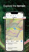
Vector Maps based on OpenStreetMap data
- There is no limit on the number of countries/regions you can download.
- Detailed and informative.
- Up-to-date and accurate – we update them monthly.
- Take up less space than others and work really fast – the app uses GPUs in addition to CPUs to render vector maps.
- Changeable size of labels – large labels on maps is extremely useful while driving.
- Multiple languages support – map labels will be changed to the selected language immediately.
Offline Search
- Incredible fast – results appear instantly as you type.
- It works in a variety of ways – by object name, category or even by GPS coordinates.
- It finds objects in multiple languages – this will make your searching much easier than ever.
- No internet connection required.
Offline multi-stop routing
- Start the route from any point on the map,
- Add waypoints from search or directly from the map,
- Optimize the route with two or more via locations by the shortest time,
- Save the route for future use: edit, or navigate it later, share with your friends,
- Rewind between intermediate points while moving along the route,
- Drive circle routes with the same start and end point.
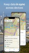
Geo Data Syncing
- iCloud and Dropbox sync supported.
- Any number of devices could sync simultaneously.
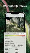
GPS Tracks Recording
- Record your trips and export them as KML/GPX files.
- Monitor your real-time speed, distance and time traveled, as well as altitude right on the map during the trip.
- Beautiful gradients to visualize altitude and speed changes.
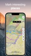
Bookmarks on the Map
- Mark your favorite places on your maps and set points of interest for your next trip.
- Choose from lots of icons to assign to bookmarks.
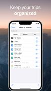
- Store your bookmarks and GPS tracks in separate collections for a quick access.
Sharing Your Geodata
- Share your itineraries from the app via Mail, Facebook, and Twitter.
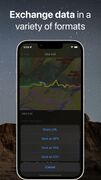
- Export them in the most common formats: KML & GPX.
Backing Up Your Data
- Back up your collections to have the copy of data that may be lost or deleted by mistake.
- Restore data to your device from the backup you created earlier in one tap.
- Transfer backup data to another iOS device or app.
Offline Maps Import
- Import previously created custom offline maps in .sqlitedb or .mbtiles format (use Mobile Atlas Creator, TileMill or SAS.Planet to generate offline maps).
And even more:
- GeoJSON & MapCSS support [1]
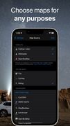
- Custom map sources support (including overlays)
- Different coordinate formats (including MGRS, Plus codes)
- Importing KML/GPX files into the app
- GPS filtering (accuracy and distance threshold)
- Bearing line to bookmark
- One finger zooming
- Measuring distance between two points on the map
Guru Maps Pro
Guru Maps Pro costs $2.50/mo, $22.50/year or $67.50 for a lifetime license.
With pro you get the following features umlimited:
- Vector maps (up from 3)
- Bookmarks (up from 15)
- GPS tracks (up from 15)
- Pro map sources
- sqlitedb/mbtiles Map Support
See Also
- OsmoTagger - iOS tag editor made by Evgen Bodunov
© Evgen Bodunov, https://gurumaps.app: All screenshots and logos of Guru Maps on this page are published under CC BY-NC-ND 4.0 license.


