Herefordshire
Jump to navigation
Jump to search
| V・T・E |
| latitude: 52.037, longitude: -2.69 |
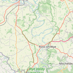
| Browse map of Herefordshire 52°02′13.20″ N, 2°41′24.00″ W |
| Edit map |
|
| External links: |
| Use this template for your locality |
Herefordshire is a county in England West Midlands at latitude 52°02′13.20″ North, longitude 2°41′24.00″ West.
Herefordshire 10187![]() 10187 is a ceremonial county and unitary authority in the West Midlands region of England. It borders the English counties of Shropshire, Worcestershire and Gloucestershire, and the Welsh preserved counties of Gwent and Powys.
10187 is a ceremonial county and unitary authority in the West Midlands region of England. It borders the English counties of Shropshire, Worcestershire and Gloucestershire, and the Welsh preserved counties of Gwent and Powys.
Cities and Towns in Herefordshire
A list of major settlements within the county of Herefordshire:
Taken from the Wikipedia artcile: Herefordshire - Cities, towns and villages