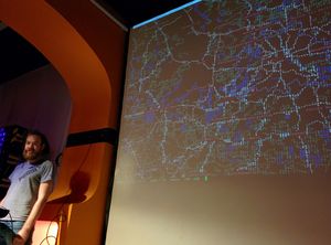
JA:Mapscii

mapsciiはOpenStreetMapを拡大縮小して表示できる「ASCIIアート」です。
mapsciiのGitHubリポジトリ(mapsciiを実行する方法と,動作風景もあります)
閲覧
端末 (terminal) で地図を閲覧するには,mapsciiサーバーにtelnet通信するか,自分でNode.js appを実行するかします。
telnet mapscii.me
とすればよいでしょう。
もしも接続が予期せず切断した場合は,telnet -E mapscii.meとして再接続してみてください。
サーバーからは画像ではなく文字が送られてきます。 地図を探索するには次のように鍵盤を操作します。
- ↑, ↓, ←, → – 移動する;
- a or z – 拡大/縮小;
- c – Unicode点字フォントとASCIIフォントによる表示を切り替える;
- q – mapsciiを終了する。
または,端末がマウスによる操作に対応していた場合は,地図をドラッグして移動したり,スクロールして拡大/縮小したりできます。 クリックするとその部分を中央にして表示されます。
端末の動作要件
Xterm互換の模倣に対応している端末(ほとんどのtelnetクライアントはこれに対応しているでしょう)と,システムに用意されている適切な等幅フォントで描画された(点字を含む)記号のUnicode文字(UTF-8符号化)を準備する必要があります。
For now the default telnet client of Windows is not supported (no compatible Xterm emulation, it supports only the "ANSI.SYS" legacy terminal emulation inherited from DOS and all past versions of Windows), but you can use the open source client PuTTY to connect. If you are using Windows 10, you can run the native Linux telnet client from the "Ubuntu Bash" optional feature, supported by Microsoft. After connecting press c to activate the raw ASCII mode as otherwise some symbols will not be rendered if your system does not have fonts to render them with suitable monospace metrics. Instead they will be shown as squared "?" symbols (not allowing you to see the distinctive Braille dot patterns or other symbols).
手許への導入
mapsciiをNode.js appとして手許で実行するには,Linux上で導入する方法を参照してください。